1947 Map of Gurabo SO
USGS Topo · Published 1947About this map
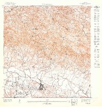
The town of Gurabo sits at the foot of the mountains where the central valley meets the winding Rio Gurabo. This 1947 topographic study shows the community before the rapid urbanization of the mid-20th century, revealing a landscape defined by plantation-era infrastructure and steep rural topography. To the west, a large Military Reservation occupies the lowlands, while the northeastern hills are home to the Escuela Segunda Unidad de Quebrada Infierno. The influence of the local sugar industry is visible in specialized roadway labels like Sugar and Steel Derrick near the junction of Eastern and Associates. Notable high points like La Silla and VABM Nuevo provide clear orientation for the complex terrain north of the principal settlement at Alto Nuevo.
Find a feature on this map
15 named features on this map. Tap any name to fly to it.
Don’t see what you’re looking for? This feature index may not catch every label — zoom into the map to look around manually.
Map Details
Editions of this 1947 Gurabo SO Map
This is the sole edition of this map. No revisions or reprints were ever made.
Historical Maps of Juncos Through Time
1 maps found
Featured Locations
- Carolina
- Sector Goyo Márquez, Gurabo
- Gurabo, Gurabo
- Sector El Regente, Trujillo Alto
- Valle Buenos Aires, Trujillo Alto