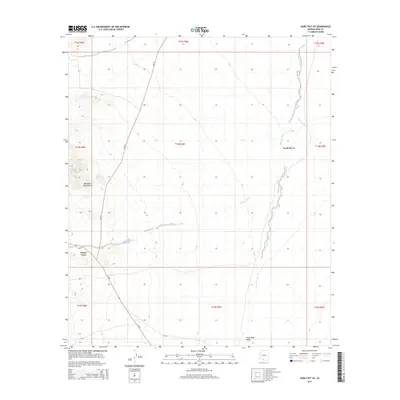
2014 Map of Gurli Put Vo
USGS Topo · Published 2014About this map
Gurli Put Vo and Maish Vaya serve as the primary focal points of this Gu Achi District landscape, situated within the expansive Santa Rosa Valley. The geography is defined by a network of seasonal watercourses, including Quijotoa Wash, Ak Chin Wash, and Ko Vaya Wash, which reveal the hydrological patterns of the Sonoran desert. To the west, the Brownell Mountains provide a distinct topographical break from the valley floor. Transportation across this Tohono O'odham Nation territory is facilitated by a grid of routes such as Az-86 and Bureau of Indian Affairs roads like Bia-15 and Bia-32. This 2014 survey documents the enduring settlement patterns and road networks that connect these indigenous communities, offering a precise view of the region's modern infrastructure and natural landmarks.
Find a feature on this map
22 named features on this map. Tap any name to fly to it.
Don’t see what you’re looking for? This feature index may not catch every label — zoom into the map to look around manually.
Map Details
Editions of this 2014 Gurli Put Vo Map
This is the sole edition of this map. No revisions or reprints were ever made.
Other maps of this area
1934 · Silver Bell
USGS Topo · 1:125,000
1937 · Comobabi
USGS Topo · 1:48,000
1942 · Comobabi
USGS Topo · 1:62,500
1953 · Ajo
USGS Topo · 1:250,000

1956 · Tucson
USGS Topo · 1:250,000
1957 · Ajo
USGS Topo · 1:250,000
1958 · Ajo
USGS Topo · 1:250,000
1958 · Tucson
USGS Topo · 1:250,000
1959 · Tucson
USGS Topo · 1:250,000
1962 · Ajo
USGS Topo · 1:250,000