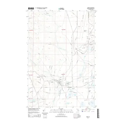
2014 Map of Gwinn
USGS Topo · Published 2014About this map
Gwinn and the surrounding mining-era settlements of Princeton, Austin, and New Swanzy occupy the central valley of the Escanaba River system in Marquette County. This 2014 survey captures the significant aviation presence at the northern edge of the quadrangle, where Sawyer International Airport and the residential community of K I Sawyer occupy the former air force base grounds. The landscape is defined by the convergence of the Middle Branch Escanaba River and the East Branch Escanaba River, creating a complex network of wetlands and small lakes like Shag Lake and Johnson Lake. The map details the transition from the concentrated residential streets of Gwinn to the open tracts of the Plains and the scattered clearings at Swanzy. Genealogists will find the location of the Gwinn Cem and various local access routes like Kelly Johnson Memorial Dr useful for placing family sites within this historic iron-mining district.
Find a feature on this map
155 named features on this map. Tap any name to fly to it.
Don’t see what you’re looking for? This feature index may not catch every label — zoom into the map to look around manually.
Map Details
Editions of this 2014 Gwinn Map
This is the sole edition of this map. No revisions or reprints were ever made.
Other maps of this area

1932 · Helena NW
USGS Topo · 1:31,680

1932 · Helena NE
USGS Topo · 1:31,680

1932 · Harvey NW
USGS Topo · 1:31,680

1932 · Harvey SE
USGS Topo · 1:31,680

1932 · Harvey SW
USGS Topo · 1:31,680

1932 · Harvey NE
USGS Topo · 1:31,680

1951 · Helena NE
USGS Topo · 1:31,680

1951 · Helena NW
USGS Topo · 1:31,680

1952 · Sands
USGS Topo · 1:24,000

1952 · Ishpeming
USGS Topo · 1:62,500