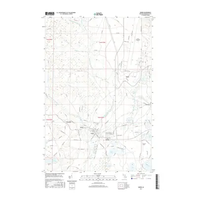
2017 Map of Gwinn
USGS Topo · Published 2017About this map
Gwinn and its surrounding Upper Peninsula settlements occupy the convergence of the East Branch Escanaba River and the Middle Branch Escanaba River. This 2017 survey details a landscape where industrial history and modern infrastructure coexist, from the S Francis Mine Dr to the expansive Sawyer International Airport in the northeast. The residential patterns in New Swanzy, Princeton, and Austin reflect the township's development alongside the river system and local resource extraction. To the south, the water-dominant terrain is marked by the Boney Falls Basin and numerous glacial lakes, including Johnson Lake, Bertrand Lake, and Shag Lake. Local history is anchored at the Gwinn Cem and Lesterson Field, while the dense network of county roads like N Co Rd 557 and Co Rd EEB provides a clear view of the modern transportation layout in Forsyth Township.
Find a feature on this map
133 named features on this map. Tap any name to fly to it.
Don’t see what you’re looking for? This feature index may not catch every label — zoom into the map to look around manually.
Map Details
Editions of this 2017 Gwinn Map
This is the sole edition of this map. No revisions or reprints were ever made.
Other maps of this area

1932 · Helena NW
USGS Topo · 1:31,680

1932 · Helena NE
USGS Topo · 1:31,680

1932 · Harvey NW
USGS Topo · 1:31,680

1932 · Harvey SE
USGS Topo · 1:31,680

1932 · Harvey SW
USGS Topo · 1:31,680

1932 · Harvey NE
USGS Topo · 1:31,680

1951 · Helena NE
USGS Topo · 1:31,680

1951 · Helena NW
USGS Topo · 1:31,680

1952 · Sands
USGS Topo · 1:24,000

1952 · Ishpeming
USGS Topo · 1:62,500