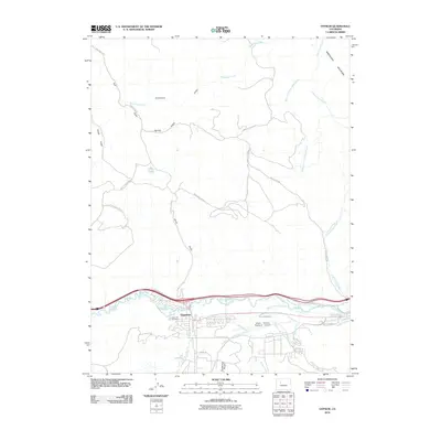
2010 Map of Gypsum
USGS Topo · Published 2010About this map
The Gypsum townsite serves as the central hub of this 2010 survey, positioned along the banks of the Eagle River. The landscape is defined by its water management systems, featuring a complex network of irrigation channels including the Stremme and Gates Ditch, Casper Schumm Ditch, and the Chatfield and Bartholomew Ditch. These ditches reflect the area's agricultural history and the essential role of water rights in this high-elevation terrain. North of the river, the topography rises sharply toward Greenhorn Mountain, dissected by numerous drainage features such as Agnew Gulch and Greenhorn Gulch. Modern infrastructure like the Eagle County Regional Airport and Red Hill Beacon Rd contrasts with local landmarks like the Cedar Hill Cemetery, providing a detailed view of the community's evolution near the confluence of Gypsum Creek and the main river valley.
Find a feature on this map
38 named features on this map. Tap any name to fly to it.
Don’t see what you’re looking for? This feature index may not catch every label — zoom into the map to look around manually.
Map Details
Editions of this 2010 Gypsum Map
This is the sole edition of this map. No revisions or reprints were ever made.
Other maps of this area

1927 · Glenwood Springs
USGS Topo · 1:125,000

1930 · Glenwood Springs
USGS Topo · 1:125,000

1957 · Leadville
USGS Topo · 1:250,000

1959 · Leadville
USGS Topo · 1:250,000

1960 · Leadville
USGS Topo · 1:250,000

1961 · Cottonwood Pass
USGS Topo · 1:24,000

1962 · Leadville
USGS Topo · 1:250,000

1962 · Gypsum
USGS Topo · 1:24,000
1962 · Suicide Mountain
USGS Topo · 1:24,000

1962 · Eagle
USGS Topo · 1:24,000