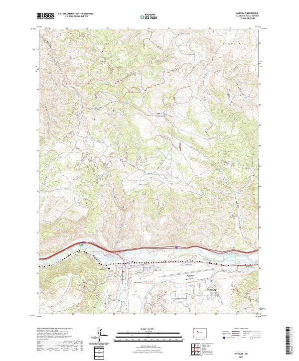
2022 Map of Gypsum
USGS Topo · Published 2022About this map
Gypsum sits at the confluence of the Eagle River and Gypsum Cr, serving as a vital hub for the ranching and transportation networks of Eagle County. This 2022 survey reveals a complex landscape where traditional irrigation systems, such as the Casper-Schumm Ditch and the Chatfield and Bartholomew Ditch, operate alongside modern infrastructure like the Eagle County Regional Airport. The town's residential growth is evident in the detailed street layouts of neighborhoods like Cotton Ranch Dr, while local heritage is anchored by the Cedar Hill Memorial Cem.
Find a feature on this map
137 named features on this map. Tap any name to fly to it.
Don’t see what you’re looking for? This feature index may not catch every label — zoom into the map to look around manually.
Map Details
Editions of this 2022 Gypsum Map
This is the sole edition of this map. No revisions or reprints were ever made.
Other maps of this area

1927 · Glenwood Springs
USGS Topo · 1:125,000

1930 · Glenwood Springs
USGS Topo · 1:125,000

1957 · Leadville
USGS Topo · 1:250,000

1959 · Leadville
USGS Topo · 1:250,000

1960 · Leadville
USGS Topo · 1:250,000

1961 · Cottonwood Pass
USGS Topo · 1:24,000

1962 · Leadville
USGS Topo · 1:250,000

1962 · Gypsum
USGS Topo · 1:24,000
1962 · Suicide Mountain
USGS Topo · 1:24,000

1962 · Eagle
USGS Topo · 1:24,000