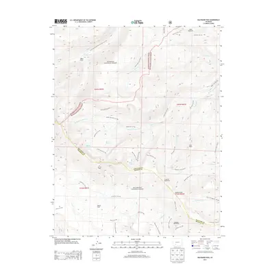
2013 Map of Halfmoon Pass
USGS Topo · Published 2013About this map
Halfmoon Pass and the surrounding high-altitude terrain of the La Garita Mountains define this section of the southern Colorado Rockies. This 2013 survey illustrates a complex web of drainage and trail systems crossing the boundary between Gunnison National Forest and Rio Grande National Forest. Notable water features include the Beaver Ponds, Machin Lake, and Benito Lake, which feed into the numerous forks of the Middle Fork Saguache Creek. The map documents significant geological and recreational landmarks like Wheeler Monument and Cañon Diablo. Hikers and researchers can trace the Continental Divide National Scenic Trail as it traverses the western edge, while a dense network of secondary paths like the Wason Trail and Machin Basin Trail provides access to remote areas like Wason Park.
Find a feature on this map
51 named features on this map. Tap any name to fly to it.
Don’t see what you’re looking for? This feature index may not catch every label — zoom into the map to look around manually.
Map Details
Editions of this 2013 Halfmoon Pass Map
This is the sole edition of this map. No revisions or reprints were ever made.
Other maps of this area

1914 · Creede
USGS Topo · 1:125,000

1916 · Creede
USGS Topo · 1:125,000

1945 · Durango
USGS Topo · 1:250,000

1953 · Durango
USGS Topo · 1:250,000

1954 · Durango
USGS Topo · 1:250,000

1956 · Montrose
USGS Topo · 1:250,000

1959 · Montrose
USGS Topo · 1:250,000

1959 · Creede
USGS Topo · 1:62,500

1960 · Montrose
USGS Topo · 1:250,000

1961 · Durango
USGS Topo · 1:250,000