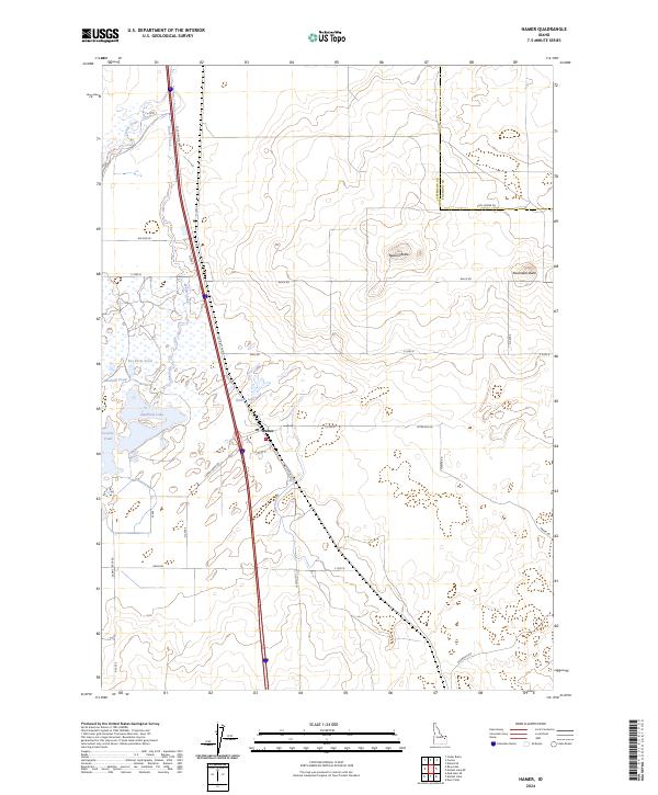
2024 Map of Hamer
USGS Topo · Published 2024About this map
Hamer serves as the primary hub of this eastern Idaho landscape, where the high desert meets the marshlands of the Camas National Wildlife Refuge. The settlement’s position at the intersection of N Old Hwy 91 and various county roads like Peterson Rd underscores its role as a local center for commerce and transport. The terrain is defined by volcanic landmarks such as Beacon Butte and Raumaker Butte, which rise above a complex network of water features including Sandhole Lake and Hamer Lake. Irrigation and water management are vital to this environment, evidenced by the presence of Hamer Ditch and numerous ponds like Rat Farm Pond and Muskrat Pond. These features highlight the careful balance between agricultural water use and the preservation of natural habitats along Camas Creek, providing a detailed look at the modern land-use patterns of Jefferson County.
Find a feature on this map
39 named features on this map. Tap any name to fly to it.
Don’t see what you’re looking for? This feature index may not catch every label — zoom into the map to look around manually.
Map Details
Editions of this 2024 Hamer Map
This is the sole edition of this map. No revisions or reprints were ever made.
Other maps of this area

1955 · Dubois
USGS Topo · 1:250,000

1955 · Idaho Falls
USGS Topo · 1:250,000

1958 · Dubois
USGS Topo · 1:250,000

1958 · Idaho Falls
USGS Topo · 1:250,000
1964 · Market Lake
USGS Topo · 1:24,000
1964 · Deer Parks
USGS Topo · 1:24,000

1964 · Mud Lake SE
USGS Topo · 1:24,000
1964 · Hamer
USGS Topo · 1:24,000

1964 · Camas
USGS Topo · 1:24,000

1964 · Rays Lake
USGS Topo · 1:24,000