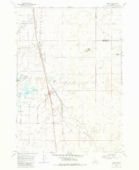
1964 Map of Hamer
USGS Topo · Published 1983About this map
Hamer serves as the primary outpost in this high desert landscape, positioned along the Union Pacific railroad corridor. The area is defined by the extensive wetlands of the Camas National Wildlife Refuge, where water features like Sandhole Lake, Muskrat Pond, and Mallard Slough provide a stark contrast to the surrounding volcanic terrain of Beacon Butte and Raumaker Butte. This 1964 survey, based on aerial photographs from 1959, reveals an intricate network of water management and transportation essential to local life, including the Hamer Ditch and several Flowing Wells. Notable landmarks like the Rat Farm and the Roadside Rest along the main highway (marked as 15 and 91) highlight the utilitarian nature of the settlement. The map also records the Jefferson and Fremont County boundary as it cuts across the northern edge of this irrigation-dependent region.
Find a feature on this map
27 named features on this map. Tap any name to fly to it.
Don’t see what you’re looking for? This feature index may not catch every label — zoom into the map to look around manually.
Map Details
Editions of this 1964 Hamer Map
2 editions found
Other maps of this area

1955 · Dubois
USGS Topo · 1:250,000

1955 · Idaho Falls
USGS Topo · 1:250,000

1958 · Dubois
USGS Topo · 1:250,000

1958 · Idaho Falls
USGS Topo · 1:250,000
1964 · Market Lake
USGS Topo · 1:24,000
1964 · Deer Parks
USGS Topo · 1:24,000

1964 · Mud Lake SE
USGS Topo · 1:24,000
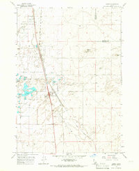
1964 · Hamer
USGS Topo · 1:24,000

1964 · Camas
USGS Topo · 1:24,000

1964 · Rays Lake
USGS Topo · 1:24,000