
1964 Map of Rays Lake
USGS Topo · Published 1966About this map
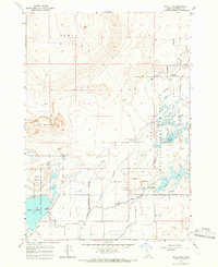
Camas Creek meanders through a landscape defined by significant water management and wildlife conservation efforts during the mid-1960s. This desert-edge environment in Idaho is anchored by the National Wildlife Refuge, where the Refuge Headquarters and a Lookout Tower monitor the expansive wetlands of Rays Lake and Two-way Pond. The map reveals a complex network of man-made irrigation features, including the Camas Creek Canal, Independent Ditch, and Holly Canal, which contrast with the natural volcanic topography of Table Butte and the eroded slopes of The Breaks.
Find a feature on this map
30 named features on this map. Tap any name to fly to it.
Don’t see what you’re looking for? This feature index may not catch every label — zoom into the map to look around manually.
Map Details
Editions of this 1964 Rays Lake Map
2 editions found
Other maps of this area

1955 · Dubois
USGS Topo · 1:250,000

1955 · Idaho Falls
USGS Topo · 1:250,000

1958 · Dubois
USGS Topo · 1:250,000

1958 · Idaho Falls
USGS Topo · 1:250,000

1964 · Terreton
USGS Topo · 1:24,000
1964 · Market Lake
USGS Topo · 1:24,000

1964 · Cedar Butte SW
USGS Topo · 1:24,000

1964 · Mud Lake SE
USGS Topo · 1:24,000
1964 · Hamer
USGS Topo · 1:24,000

1964 · Mud Lake NW
USGS Topo · 1:24,000