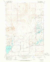
1964 Map of Rays Lake
USGS Topo · Published 1966About this map
Camas National Wildlife Refuge and the Mud Lake State Wildlife Management Area dominate this high-desert wetland system in eastern Idaho. The 1964 survey captures a landscape defined by water management and natural drainage, where Camas Creek feeds into a network of marshes and open water, including Rays Lake and the northern reaches of Mud Lake. The presence of several human-engineered water systems like the Independent Ditch and Jackett Canal underscores the region's reliance on irrigation and habitat preservation.
Find a feature on this map
27 named features on this map. Tap any name to fly to it.
Don’t see what you’re looking for? This feature index may not catch every label — zoom into the map to look around manually.
Map Details
Editions of this 1964 Rays Lake Map
2 editions found

Other maps of this area

1955 · Dubois
USGS Topo · 1:250,000

1955 · Idaho Falls
USGS Topo · 1:250,000

1958 · Dubois
USGS Topo · 1:250,000

1958 · Idaho Falls
USGS Topo · 1:250,000

1964 · Terreton
USGS Topo · 1:24,000
1964 · Market Lake
USGS Topo · 1:24,000

1964 · Cedar Butte SW
USGS Topo · 1:24,000

1964 · Mud Lake SE
USGS Topo · 1:24,000
1964 · Hamer
USGS Topo · 1:24,000

1964 · Mud Lake NW
USGS Topo · 1:24,000