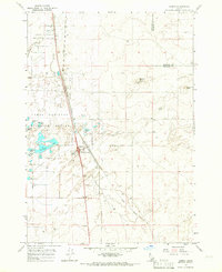
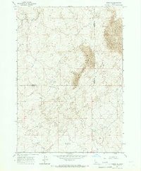
1964 Map of Hamer
USGS Topo · Published 1966About this map
Hamer sits at the junction of rail and road, serving as a vital waypoint in this high-desert landscape of eastern Idaho. The Union Pacific railroad runs parallel to the primary highway, providing the infrastructure that historically supported this agricultural and transport hub. Much of the western portion of the map is dominated by the Camas National Wildlife Refuge, an intricate network of wetlands including Sandhole Lake, Rays Lake, and Mallard Slough. These water features, along with the Hamer Ditch, highlight the essential role of water management in an area punctuated by volcanic landmarks like Beacon Butte. The presence of a Roadside Rest and a Landing Strip near the town center underscores Hamer's role as a service stop for travelers and local aviation during the mid-1960s.
Find a feature on this map
23 named features on this map. Tap any name to fly to it.
Don’t see what you’re looking for? This feature index may not catch every label — zoom into the map to look around manually.
Map Details
Editions of this 1964 Hamer Map
2 editions found
Other maps of this area

1955 · Dubois
USGS Topo · 1:250,000

1955 · Idaho Falls
USGS Topo · 1:250,000

1958 · Dubois
USGS Topo · 1:250,000

1958 · Idaho Falls
USGS Topo · 1:250,000
1964 · Market Lake
USGS Topo · 1:24,000
1964 · Deer Parks
USGS Topo · 1:24,000

1964 · Mud Lake SE
USGS Topo · 1:24,000

1964 · Camas
USGS Topo · 1:24,000

1964 · Rays Lake
USGS Topo · 1:24,000
1964 · Dubois SE
USGS Topo · 1:24,000