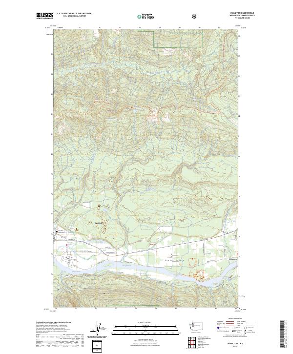
2023 Map of Hamilton
USGS Topo · Published 2023About this map
Hamilton and Birdsview occupy the fertile Skagit Valley floor along the northern banks of the Skagit River. This river corridor, designated as the Skagit Wild and Scenic River, serves as a primary geographic anchor for the region, bordered by industrial transport routes like the Crown Pacific Mainline and Lyman Hamilton Hwy. To the north, the landscape rises sharply into the Mount Baker National Forest, where Mt Josephine dominates the high ground. High-elevation water features such as Josephine Lakes and the headwaters of the South Fork Nooksack River indicate a sharp transition from the valley's settlement patterns to the unpopulated mountain interior. For local historians, the Hamilton Indian Cem and the naming of roads like Scott Paper Rd and Walders Rd offer traces of the area's social history and its long-standing connection to the timber industry.
Find a feature on this map
50 named features on this map. Tap any name to fly to it.
Don’t see what you’re looking for? This feature index may not catch every label — zoom into the map to look around manually.
Map Details
Editions of this 2023 Hamilton Map
This is the sole edition of this map. No revisions or reprints were ever made.
Other maps of this area

1899 · Stillaguamish
USGS Topo · 1:125,000

1901 · Stilaguamish
USGS Topo · 1:125,000

1909 · Mt Baker
USGS Topo · 1:192,000

1911 · Mount Vernon
USGS Topo · 1:125,000

1915 · Mt. Baker
USGS Topo · 1:250,000

1921 · Wickersham
USGS Topo · 1:62,500

1944 · Clear Lake
USGS Topo · 1:62,500

1951 · Wickersham
USGS Topo · 1:62,500

1952 · Hamilton
USGS Topo · 1:62,500

1955 · Concrete
USGS Topo · 1:250,000