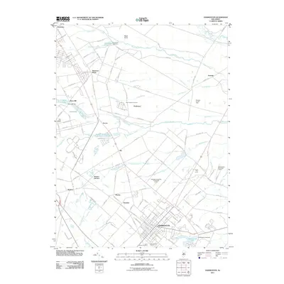
2011 Map of Hammonton
USGS Topo · Published 2011About this map
The town of Hammonton anchors this 2011 survey, showing a dense street grid punctuated by Green Mountain Cemetery and Hammonton Lake. To the northwest, the region transitions into a network of smaller communities including Waterford Works, Ancora, and the rail-linked Winslow Junction. The landscape is defined by its agricultural and transit heritage, evidenced by the large Glossy Fruit Farms and several aviation sites like the Hammonton Municipal Airport and Ideal Manufacturing Corporation Airport.
Find a feature on this map
160 named features on this map. Tap any name to fly to it.
Don’t see what you’re looking for? This feature index may not catch every label — zoom into the map to look around manually.
Map Details
Editions of this 2011 Hammonton Map
This is the sole edition of this map. No revisions or reprints were ever made.
Other maps of this area

1888 · Pemberton
USGS Topo · 1:62,500

1888 · Mount Holly
USGS Topo · 1:62,500

1890 · Hammonton
USGS Topo · 1:62,500

1890 · Mullica
USGS Topo · 1:62,500

1894 · Hammonton
USGS Topo · 1:62,500

1894 · Pemberton
USGS Topo · 1:62,500

1894 · Mount Holly
USGS Topo · 1:62,500

1894 · Mullica
USGS Topo · 1:62,500

1898 · Pemberton
USGS Topo · 1:62,500

1898 · Mount Holly
USGS Topo · 1:62,500