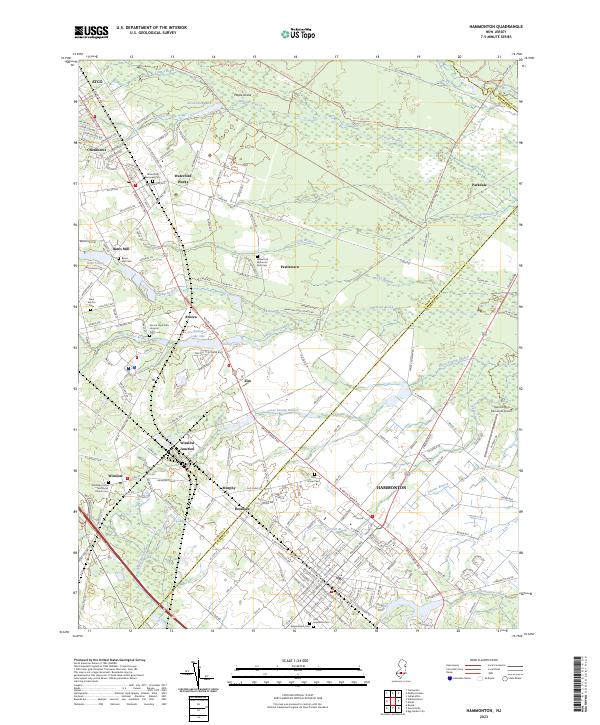
2023 Map of Hammonton
USGS Topo · Published 2023About this map
Hammonton serves as the primary hub of this South Jersey landscape, where a dense network of streets fans out near the Hammonton Municipal Airport. The region’s development is tied closely to the White Horse Pike, which cuts through several historic small settlements and crossroads including Elm, Ancora, and Rosedale. To the north, the geography shifts toward the dense pine barrens, with the Wharton State Forest Rd skirting an area defined by numerous waterways such as Albertson Brook and the Sleeper Branch. This survey is particularly useful for genealogists, as it documents a high concentration of burial grounds, including the Waterford Episcopal Cem, Bates Mill Cem, and Holy Sepulchre Cem. The presence of the Ancora Psychiatric Hospital and the significant rail crossing at Winslow Junction further define the industrial and social character of the area.
Find a feature on this map
61 named features on this map. Tap any name to fly to it.
Don’t see what you’re looking for? This feature index may not catch every label — zoom into the map to look around manually.
Map Details
Editions of this 2023 Hammonton Map
This is the sole edition of this map. No revisions or reprints were ever made.
Other maps of this area

1888 · Pemberton
USGS Topo · 1:62,500

1888 · Mount Holly
USGS Topo · 1:62,500

1890 · Hammonton
USGS Topo · 1:62,500

1890 · Mullica
USGS Topo · 1:62,500

1894 · Hammonton
USGS Topo · 1:62,500

1894 · Pemberton
USGS Topo · 1:62,500

1894 · Mount Holly
USGS Topo · 1:62,500

1894 · Mullica
USGS Topo · 1:62,500

1898 · Pemberton
USGS Topo · 1:62,500

1898 · Mount Holly
USGS Topo · 1:62,500