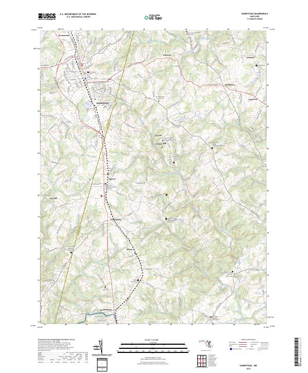
2023 Map of Hampstead
USGS Topo · Published 2023About this map
The Hampstead corridor along the Hanover Pike serves as the primary spine of this region, connecting Maryland's Carroll and Baltimore counties. This landscape is defined by its small, traditional settlements and deep commitment to local institutions, evidenced by the high density of country churches and private family burial grounds like the Cullison Family Cem and Snider Family Cem. Industrial history is anchored by Trenton Mill on Blackrock Run, while the southern reaches move through the rural hamlets of Fowblesburg, Boring, and Woodensburg. The terrain is characterized by numerous small waterways, including Prettyboy Branch and Little Piney Run, which carved the valleys that dictated the placement of these early crossroads communities and the winding routes of local roads like Upper Beckleysville Rd.
Find a feature on this map
134 named features on this map. Tap any name to fly to it.
Don’t see what you’re looking for? This feature index may not catch every label — zoom into the map to look around manually.
Map Details
Editions of this 2023 Hampstead Map
This is the sole edition of this map. No revisions or reprints were ever made.
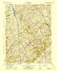
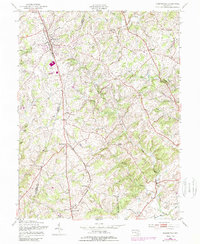
Historical Maps of Upperco Through Time
3 maps found