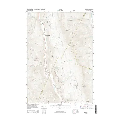
2015 Map of Hancock
USGS Topo · Published 2015About this map
The White River carves a deep valley through the center of this landscape, anchoring a chain of settlements including Granville, Lower Granville, and Hancock. This 2015 survey reveals a terrain defined by steep ridges and narrow hollows, where human habitation is tightly clustered along the river corridor and its primary tributaries like Hancock Branch and Thatcher Brook. The map serves as a vital record for genealogists, documenting numerous small burial grounds such as Elmwood Cem, Hubbard Cem, and the dual Village Cem and Old Village Cem sites near the Hancock town center.
Find a feature on this map
78 named features on this map. Tap any name to fly to it.
Don’t see what you’re looking for? This feature index may not catch every label — zoom into the map to look around manually.
Map Details
Editions of this 2015 Hancock Map
This is the sole edition of this map. No revisions or reprints were ever made.
Other maps of this area

1915 · Rochester
USGS Topo · 1:62,500

1917 · Rochester
USGS Topo · 1:62,500

1919 · Royalton
USGS Topo · 1:62,500

1919 · Lincoln Mountain
USGS Topo · 1:62,500

1920 · Lincoln Mountain
USGS Topo · 1:48,000

1921 · Lincoln Mountain
USGS Topo · 1:62,500

1922 · Barre
USGS Topo · 1:48,000

1924 · Barre
USGS Topo · 1:62,500

1924 · Randolph
USGS Topo · 1:48,000

1926 · Randolph
USGS Topo · 1:62,500