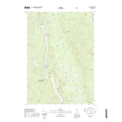
2021 Map of Hancock
USGS Topo · Published 2021About this map
Granville, Lower Granville, and Hancock follow the narrow valley of the White River, a classic Vermont settlement pattern shaped by the steep terrain of the Northfield Mountains and the Green Mountain National Forest. This modern survey reveals a landscape of high summits and deep gaps, where historical land use is still evident in the cluster of burial grounds such as Elmwood Cem, Hubbard Cem, and the Old Village Cem near the southern boundary. Higher elevations are dominated by landmarks like Mt Cushman and the Braintree Gap, while the Hancock Tunnel and various forest trails like the Tunnel Brook Trl indicate a long history of mountain passage and timber management. Numerous brooks, including Patterson Brook and Hancock Branch, drain these peaks, defining the local geography as it meets the intersection of Addison, Orange, and Windsor counties.
Find a feature on this map
85 named features on this map. Tap any name to fly to it.
Don’t see what you’re looking for? This feature index may not catch every label — zoom into the map to look around manually.
Map Details
Editions of this 2021 Hancock Map
This is the sole edition of this map. No revisions or reprints were ever made.
Other maps of this area

1915 · Rochester
USGS Topo · 1:62,500

1917 · Rochester
USGS Topo · 1:62,500

1919 · Royalton
USGS Topo · 1:62,500

1919 · Lincoln Mountain
USGS Topo · 1:62,500

1920 · Lincoln Mountain
USGS Topo · 1:48,000

1921 · Lincoln Mountain
USGS Topo · 1:62,500

1922 · Barre
USGS Topo · 1:48,000

1924 · Barre
USGS Topo · 1:62,500

1924 · Randolph
USGS Topo · 1:48,000

1926 · Randolph
USGS Topo · 1:62,500