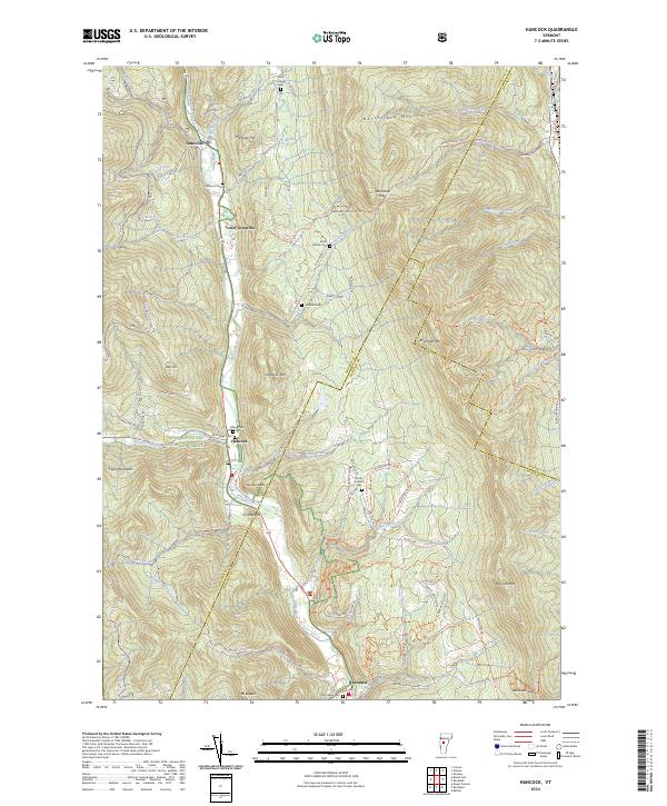
2024 Map of Hancock
USGS Topo · Published 2024About this map
The White River corridor serves as the primary artery for settlement through this mountain landscape, connecting the villages of Granville, Lower Granville, and Hancock. The map details a community deeply integrated with the surrounding terrain, where narrow valley floors provide just enough space for historic cemeteries like Elmwood Cem and Village Cem alongside the winding riverbanks. The high ridges of the Northfield Mountains and Green Mountain National Forest dominate the topography, yet the network of trails and roads such as the Braintree Mountain Rd and Post Office Hill suggests a long history of local travel and timber extraction. Local genealogy is well-represented through family-named landmarks including Mastons Hill, Hubbard Cem, and Thatcher Brook, which drain into the main valley. The presence of the Joseph Battell Wilderness and numerous logging or recreational paths like the Bowl Mill Trl and Skidoo Mtn Trl reflects the transition from early industrial use to modern conservation and recreation.
Find a feature on this map
107 named features on this map. Tap any name to fly to it.
Don’t see what you’re looking for? This feature index may not catch every label — zoom into the map to look around manually.
Map Details
Editions of this 2024 Hancock Map
This is the sole edition of this map. No revisions or reprints were ever made.
Other maps of this area

1915 · Rochester
USGS Topo · 1:62,500

1917 · Rochester
USGS Topo · 1:62,500

1919 · Royalton
USGS Topo · 1:62,500

1919 · Lincoln Mountain
USGS Topo · 1:62,500

1920 · Lincoln Mountain
USGS Topo · 1:48,000

1921 · Lincoln Mountain
USGS Topo · 1:62,500

1922 · Barre
USGS Topo · 1:48,000

1924 · Barre
USGS Topo · 1:62,500

1924 · Randolph
USGS Topo · 1:48,000

1926 · Randolph
USGS Topo · 1:62,500