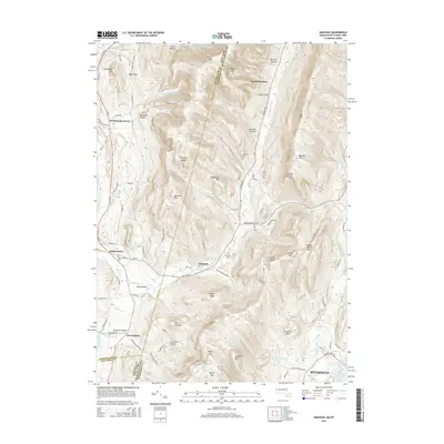
2015 Map of Hancock
USGS Topo · Published 2015About this map
The Taconic Range dominates this 2015 study of the borderlands between New York and Massachusetts, where steep ridgelines separate the drainage of the Little Hoosic River from the Kinderhook Cr and the W Br Green River. The geography here has long dictated settlement patterns, with tight hollows like Gardner Hollow and Doty Hollow housing small communities and family farms. At the center of the sheet, the town of Hancock sits at the junction of Main St and Hancock Rd, serving as a gateway to the high peaks of the Berkshire County interior.
Find a feature on this map
95 named features on this map. Tap any name to fly to it.
Don’t see what you’re looking for? This feature index may not catch every label — zoom into the map to look around manually.
Map Details
Editions of this 2015 Hancock Map
This is the sole edition of this map. No revisions or reprints were ever made.
Other maps of this area

1886 · Greylock
USGS Topo · 1:62,500

1886 · Becket
USGS Topo · 1:62,500

1888 · Becket
USGS Topo · 1:62,500

1888 · Berlin
USGS Topo · 1:62,500

1888 · Pittsfield
USGS Topo · 1:62,500

1890 · Pittsfield
USGS Topo · 1:62,500

1890 · Berlin
USGS Topo · 1:62,500

1891 · Greylock
USGS Topo · 1:62,500

1893 · Becket
USGS Topo · 1:62,500

1893 · Greylock
USGS Topo · 1:62,500