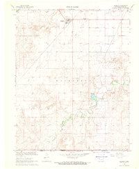
1968 Map of Hardesty
USGS Topo · Published 1969About this map
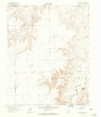
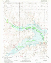
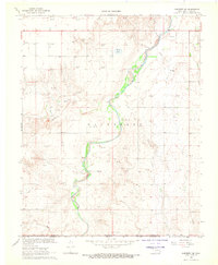
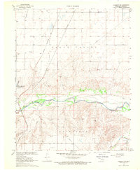
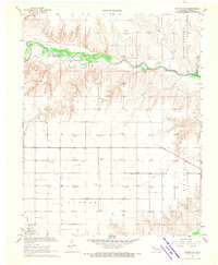
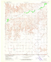
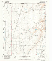
Hardesty serves as the primary hub in this Oklahoma Panhandle landscape, where the High Plains terrain is deeply incised by a network of seasonal watercourses. The local economy and geography are defined by extensive energy extraction, with numerous Gas Wells dotting the plains near the tracks of the Chicago Rock Island and Pacific railroad. The presence of Lake Schultz State Park provides a notable riparian contrast to the surrounding arid draws like Peacher Creek and Hackberry Creek. Along the northern edge, the community infrastructure is marked by the Hartsville Cem and specialized resource sites including a Sandpit and several Caliche Pits. The map also captures the transition at the state line, where Texas Co Hansford Co meets the Oklahoma border near a remote Landing Field.
Find a feature on this map
18 named features on this map. Tap any name to fly to it.
Don’t see what you’re looking for? This feature index may not catch every label — zoom into the map to look around manually.
Map Details
Editions of this 1968 Hardesty Map
This is the sole edition of this map. No revisions or reprints were ever made.
Other maps of this area

1954 · Perryton
USGS Topo · 1:250,000

1958 · Perryton
USGS Topo · 1:250,000
1962 · Hansford Camp
USGS Topo · 1:24,000
1968 · Optima Dam
USGS Topo · 1:24,000
1968 · Hardesty SE
USGS Topo · 1:24,000
1968 · Hardesty NE
USGS Topo · 1:24,000
1968 · Guymon NE
USGS Topo · 1:24,000
1968 · Guymon SE
USGS Topo · 1:24,000

1973 · Horseshoe Hill
USGS Topo · 1:24,000
1974 · Bernstein
USGS Topo · 1:24,000