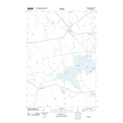
2011 Map of Harmony
USGS Topo · Published 2011About this map
Higgins Stream flows south through the village of Harmony, where the Higgins Brook Dam marks the local watercourse just before it joins with Little Ferguson Brook. This Somerset County landscape is characterized by its numerous family burial grounds, including the Chadbourne Cemetery near the northern border and the Jordan Cemetery to the south. The transition from industrial rail to modern infrastructure is evident along the eastern edge of the map, where the Boise Cascade RR Bed Rd follows the path of a former timber-hauling route. In the southern half of the quadrangle, Starbird Pond and Stafford Pond dominate the lowland geography, while elevated points like Talbot Hill and Stafford Hill provide distinctive landmarks for those tracing the historic bounds of local farmsteads and rural settlements like Mainstream and Corson Corner.
Find a feature on this map
87 named features on this map. Tap any name to fly to it.
Don’t see what you’re looking for? This feature index may not catch every label — zoom into the map to look around manually.
Map Details
Editions of this 2011 Harmony Map
This is the sole edition of this map. No revisions or reprints were ever made.
Other maps of this area

1913 · Skowhegan
USGS Topo · 1:62,500

1930 · Pittsfield
USGS Topo · 1:48,000

1932 · Pittsfield
USGS Topo · 1:62,500

1933 · Pittsfield
USGS Topo · 1:62,500

1933 · Guilford
USGS Topo · 1:62,500

1937 · Guilford
USGS Topo · 1:62,500

1948 · Bangor
USGS Topo · 1:250,000

1948 · Kingsbury
USGS Topo · 1:62,500

1950 · Kingsbury
USGS Topo · 1:62,500

1954 · Millinocket
USGS Topo · 1:250,000