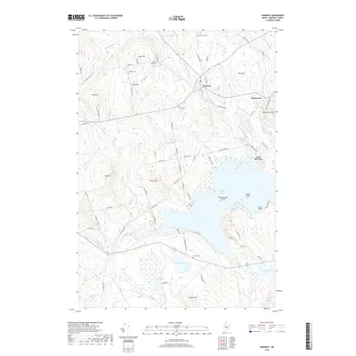
2018 Map of Harmony
USGS Topo · Published 2018About this map
Harmony serves as a central hub in this Somerset County landscape, where the waters of Higgins Stream and Main Stream Sebasticook River converge. The settlement of Mainstream sits at the river's bend, while Castle Harmony overlooks the northern reach of Great Moose Lake. This map reveals a terrain shaped by agriculture and timber, evidenced by the Boise Cascade RR Bed tracing the eastern edge. Family history is well-preserved across numerous rural burial grounds, including Chadborne Cem, North Road Cem, and the Libby Cem. Uplands like Carson Hill and Hurd Hill rise between drainage basins, while smaller water bodies such as Starbird Pond, Bog Pond, and Lake Como dot the lowlands. The survey shows a network of named country roads, including Old Rte 50 and Bean Hill Rd, which connect these dispersed homesteads and hillsides.
Find a feature on this map
91 named features on this map. Tap any name to fly to it.
Don’t see what you’re looking for? This feature index may not catch every label — zoom into the map to look around manually.
Map Details
Editions of this 2018 Harmony Map
This is the sole edition of this map. No revisions or reprints were ever made.
Other maps of this area

1913 · Skowhegan
USGS Topo · 1:62,500

1930 · Pittsfield
USGS Topo · 1:48,000

1932 · Pittsfield
USGS Topo · 1:62,500

1933 · Pittsfield
USGS Topo · 1:62,500

1933 · Guilford
USGS Topo · 1:62,500

1937 · Guilford
USGS Topo · 1:62,500

1948 · Bangor
USGS Topo · 1:250,000

1948 · Kingsbury
USGS Topo · 1:62,500

1950 · Kingsbury
USGS Topo · 1:62,500

1954 · Millinocket
USGS Topo · 1:250,000