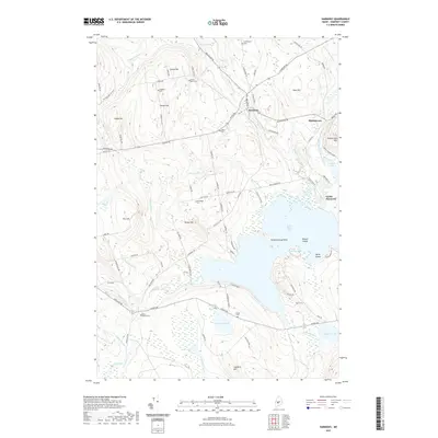
2021 Map of Harmony
USGS Topo · Published 2021About this map
Harmony serves as the central hub of this Somerset County landscape, where the confluence of Higgins Stream and Main Stream Sebasticook River shaped early settlement patterns. This 2021 survey documents a region defined by its water and timber heritage, notably preserved in the alignment of the Boise Cascade RR Bed near Mainstream. The map provides a detailed look at the rural cemeteries that anchor the area's genealogy, including Wormlight Cem near Talbot Hill and Jordan Cem by Starbird Pond. Significant topographic features like Mainstream Mtn and Hurd Hill rise above the extensive wetlands and numerous ponds, such as Perry Pond and Stafford Pond, which feed the local drainage systems. The transition from active rail to recreational or industrial beds is evident, while the shoreline of Great Moose Lake shows the complex geography of The Narrows and Passaconaway Point.
Find a feature on this map
102 named features on this map. Tap any name to fly to it.
Don’t see what you’re looking for? This feature index may not catch every label — zoom into the map to look around manually.
Map Details
Editions of this 2021 Harmony Map
This is the sole edition of this map. No revisions or reprints were ever made.
Other maps of this area

1913 · Skowhegan
USGS Topo · 1:62,500

1930 · Pittsfield
USGS Topo · 1:48,000

1932 · Pittsfield
USGS Topo · 1:62,500

1933 · Pittsfield
USGS Topo · 1:62,500

1933 · Guilford
USGS Topo · 1:62,500

1937 · Guilford
USGS Topo · 1:62,500

1948 · Bangor
USGS Topo · 1:250,000

1948 · Kingsbury
USGS Topo · 1:62,500

1950 · Kingsbury
USGS Topo · 1:62,500

1954 · Millinocket
USGS Topo · 1:250,000