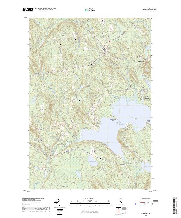
2024 Map of Harmony
USGS Topo · Published 2024About this map
Harmony serves as a central hub in this section of Somerset County, where Higgins Stream and Main Stream converge toward the expansive waters of Great Moose Lake. The landscape is a transition from the elevated peaks of Dore Hill and Mainstream Mtn down to the marshy lowlands surrounding Big Pond and Starbird Pond. This modern survey documents the historical footprint of the region through numerous family and community burial grounds, such as Chadbourne Cem and Wormlight Cem, which are scattered among the ridges.
Find a feature on this map
106 named features on this map. Tap any name to fly to it.
Don’t see what you’re looking for? This feature index may not catch every label — zoom into the map to look around manually.
Map Details
Editions of this 2024 Harmony Map
This is the sole edition of this map. No revisions or reprints were ever made.
Other maps of this area

1913 · Skowhegan
USGS Topo · 1:62,500

1930 · Pittsfield
USGS Topo · 1:48,000

1932 · Pittsfield
USGS Topo · 1:62,500

1933 · Pittsfield
USGS Topo · 1:62,500

1933 · Guilford
USGS Topo · 1:62,500

1937 · Guilford
USGS Topo · 1:62,500

1948 · Bangor
USGS Topo · 1:250,000

1948 · Kingsbury
USGS Topo · 1:62,500

1950 · Kingsbury
USGS Topo · 1:62,500

1954 · Millinocket
USGS Topo · 1:250,000