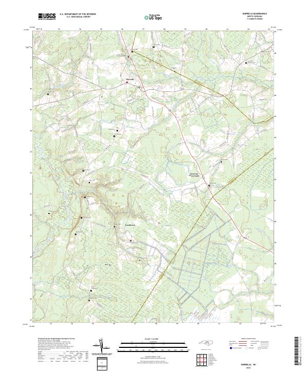
2022 Map of Harrells
USGS Topo · Published 2022About this map
Harrells and the surrounding coastal plain of Sampson County are defined by a network of slow-moving water and low-lying basins. The settlement of Newtons Crossroads serves as a central junction, while smaller hamlets like Ezzelltown are tucked between the Black River and numerous wetlands known locally as bays, such as Bear Bay and Gap Bay. The landscape is etched with history through dozens of family and church-affiliated burial sites, including the Iron Mine Burial Ground and Royal Chapel Cem. These features, alongside drainage systems like Mill Cr and Bulltail Cr, reveal a rural economy still deeply tied to its hydrology and traditional land divisions. The transition across county lines into Duplin and Pender is marked by these same winding creeks and named timberlands, illustrating the persistent geography of eastern North Carolina.
Find a feature on this map
76 named features on this map. Tap any name to fly to it.
Don’t see what you’re looking for? This feature index may not catch every label — zoom into the map to look around manually.
Map Details
Editions of this 2022 Harrells Map
This is the sole edition of this map. No revisions or reprints were ever made.
Other maps of this area

1953 · Florence
USGS Topo · 1:250,000

1954 · Florence
USGS Topo · 1:250,000

1954 · White Lake
USGS Topo · 1:62,500

1955 · Atkinson
USGS Topo · 1:62,500

1959 · Garland
USGS Topo · 1:62,500

1962 · Rose Hill
USGS Topo · 1:62,500

1982 · Elizabethtown
USGS Topo · 1:100,000
1984 · Harrells
USGS Topo · 1:24,000
1984 · Delway
USGS Topo · 1:24,000
1984 · Rose Hill
USGS Topo · 1:24,000