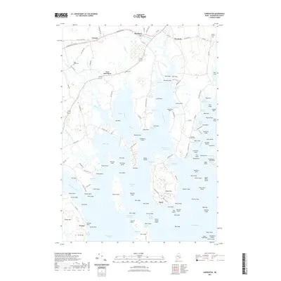
2021 Map of Harrington
USGS Topo · Published 2021About this map
The Harrington River and Narraguagus River define this coastal landscape, where narrow inlets and expansive tidal flats carve into the Washington County shoreline. The town of Harrington sits at the head of the tide, supported by outlying settlements at West Harrington, Dorman, and Marshville. The area's maritime and terrestrial history is preserved in several local burial grounds, including Church Hill Cem and Rock Maple Cem, which serve as vital landmarks for genealogists.
Find a feature on this map
157 named features on this map. Tap any name to fly to it.
Don’t see what you’re looking for? This feature index may not catch every label — zoom into the map to look around manually.
Map Details
Editions of this 2021 Harrington Map
This is the sole edition of this map. No revisions or reprints were ever made.
Other maps of this area

1902 · Cherryfield
USGS Topo · 1:62,500

1904 · Cherryfield
USGS Topo · 1:62,500

1904 · Petit Manan
USGS Topo · 1:62,500

1921 · Great Wass Island
USGS Topo · 1:62,500

1921 · Columbia Falls
USGS Topo · 1:62,500

1921 · Columbia Falls
USGS Topo · 1:62,500

1941 · Columbia Falls
USGS Topo · 1:62,500

1942 · Cherryfield
USGS Topo · 1:62,500

1942 · Columbia Falls
USGS Topo · 1:62,500
1948 · Columbia Falls
USGS Topo · 1:24,000