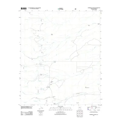
2011 Map of Harrison Canyon
USGS Topo · Published 2011About this map
Sunset serves as a central reference point in this Graham County landscape, where the high desert meets the drainages of the Ash Creek Black Hills. The map reveals a high concentration of established cattle operations and landholdings, including the Fulmer Ranch, Byrd Ranch, and Bosley Ranch. Water management is the primary driver of settlement here, evidenced by a network of engineered tanks like Little Bull Tank and Lane Tank alongside natural features like Renee Spring and Cassidy Spring. This drainage network is dominated by the forks of Ash Creek and the long course of Harrison Creek, which gives its name to the prominent Harrison Canyon. The infrastructure is characterized by remote outposts such as the McGee Windmill, highlighting the reliance on groundwater for livestock in this arid Arizona corridor.
Find a feature on this map
36 named features on this map. Tap any name to fly to it.
Don’t see what you’re looking for? This feature index may not catch every label — zoom into the map to look around manually.
Map Details
Editions of this 2011 Harrison Canyon Map
This is the sole edition of this map. No revisions or reprints were ever made.
Other maps of this area

1938 · Galiuro Mts
USGS Topo · 1:48,000

1940 · Sierra Bonita Ranch
USGS Topo · 1:62,500

1942 · Sierra Bonita Ranch
USGS Topo · 1:62,500

1943 · Galiuro Mts
USGS Topo · 1:62,500

1943 · Sierra Bonita Ranch
USGS Topo · 1:62,500

1943 · Winchester Mts.
USGS Topo · 1:62,500

1945 · Redington
USGS Topo · 1:62,500

1945 · Winchester Mts.
USGS Topo · 1:62,500

1956 · Tucson
USGS Topo · 1:250,000

1957 · Redington
USGS Topo · 1:62,500