2023 Map of Harrisville
USGS Topo · Published 2023About this map
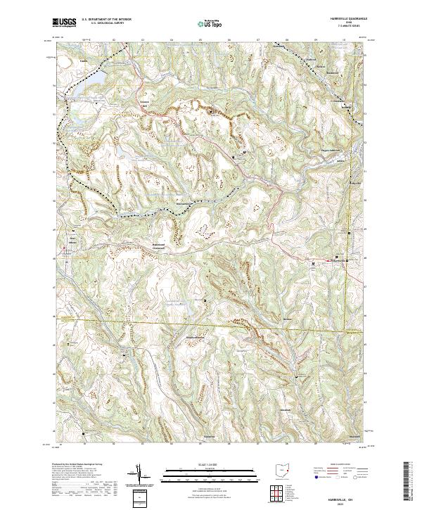
Industrial water management and historic burying grounds define the landscape where Harrison and Belmont counties meet. The area’s coal mining legacy is etched into the terrain through extensive infrastructure like the Consolidation Coal Company Pond 0107 and the various reservoirs of the Georgetown Plant, including the Georgetown Plant Upper Supply Pond. These large-scale water features contrast with the numerous small family and community cemeteries, such as the Friends Meeting House Cem and West Grove Cem, which serve as quiet markers of the region's 19th-century settlement.
Find a feature on this map
135 named features on this map. Tap any name to fly to it.
Don’t see what you’re looking for? This feature index may not catch every label — zoom into the map to look around manually.
Map Details
Editions of this 2023 Harrisville Map
This is the sole edition of this map. No revisions or reprints were ever made.