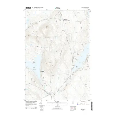
2014 Map of Hartland
USGS Topo · Published 2014About this map
Great Moose Lake and the Sebasticook River dominate the landscape of central Somerset County in this 2014 survey. The topography is defined by significant elevations such as Saint Albans Mtn, Mainstream Mtn, and the distinctive Devils Head ridge. The village of Saint Albans serves as a primary hub, situated near the outlet of Indian Pond and the winding course of Indian Stream. Southward, the town of Hartland sits at a crossroads of local transportation, where the river system influences the settlement pattern. For those researching family history, the map identifies numerous burial grounds including Maloon Cem, Watson Cem, and Wing Cem, which are scattered throughout the wooded uplands. Numerous named points such as Sandbar Point and islands like Two Pine Island characterize the intricate shoreline of the region's larger water bodies.
Find a feature on this map
112 named features on this map. Tap any name to fly to it.
Don’t see what you’re looking for? This feature index may not catch every label — zoom into the map to look around manually.
Map Details
Editions of this 2014 Hartland Map
This is the sole edition of this map. No revisions or reprints were ever made.
Other maps of this area

1913 · Skowhegan
USGS Topo · 1:62,500

1930 · Pittsfield
USGS Topo · 1:48,000

1932 · Pittsfield
USGS Topo · 1:62,500

1933 · Pittsfield
USGS Topo · 1:62,500

1933 · Guilford
USGS Topo · 1:62,500

1937 · Guilford
USGS Topo · 1:62,500

1948 · Bangor
USGS Topo · 1:250,000

1948 · Kingsbury
USGS Topo · 1:62,500

1950 · Kingsbury
USGS Topo · 1:62,500

1954 · Millinocket
USGS Topo · 1:250,000