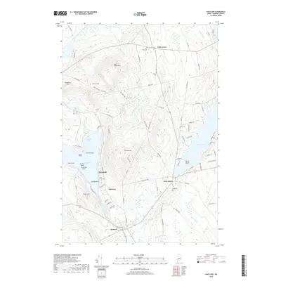
2018 Map of Hartland
USGS Topo · Published 2018About this map
Saint Albans and Hartland anchor this Somerset County landscape, where the waters of the Sebasticook River and Indian Stream converge. The terrain is defined by significant elevations like Saint Albans Mtn and Devils Head, while the shoreline of Great Moose Lake is intricately detailed with features such as Packard Point, Torry Island, and Sandbar Point. Local history is preserved through several family and community burial grounds, including West Ripley Cem, Watson Cem, and Wing Cem.
Find a feature on this map
94 named features on this map. Tap any name to fly to it.
Don’t see what you’re looking for? This feature index may not catch every label — zoom into the map to look around manually.
Map Details
Editions of this 2018 Hartland Map
This is the sole edition of this map. No revisions or reprints were ever made.
Other maps of this area

1913 · Skowhegan
USGS Topo · 1:62,500

1930 · Pittsfield
USGS Topo · 1:48,000

1932 · Pittsfield
USGS Topo · 1:62,500

1933 · Pittsfield
USGS Topo · 1:62,500

1933 · Guilford
USGS Topo · 1:62,500

1937 · Guilford
USGS Topo · 1:62,500

1948 · Bangor
USGS Topo · 1:250,000

1948 · Kingsbury
USGS Topo · 1:62,500

1950 · Kingsbury
USGS Topo · 1:62,500

1954 · Millinocket
USGS Topo · 1:250,000