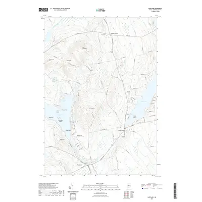
2021 Map of Hartland
USGS Topo · Published 2021About this map
Saint Albans and Hartland anchor the southern portion of this Somerset County landscape, where the Sebasticook River and Indian Stream converge near the local center of commerce. The terrain is defined by significant elevations like Saint Albans Mtn and The Pinnacles, while the western edge is dominated by the expansive waters of Great Moose Lake. This survey illustrates a rural network of small settlements such as Todds Corner and Cyrs, connected by winding roads that skirt the numerous bogs and brooks. Genealogists will find several burial grounds noted, including the Village Cem in Saint Albans and the Ireland Cem further south. The map details a varied shoreline at Northeast Cove and Sandbar Point, alongside named islands like Birch Island and Two Pine Island, reflecting a landscape deeply integrated with its interior waterways.
Find a feature on this map
109 named features on this map. Tap any name to fly to it.
Don’t see what you’re looking for? This feature index may not catch every label — zoom into the map to look around manually.
Map Details
Editions of this 2021 Hartland Map
This is the sole edition of this map. No revisions or reprints were ever made.
Other maps of this area

1913 · Skowhegan
USGS Topo · 1:62,500

1930 · Pittsfield
USGS Topo · 1:48,000

1932 · Pittsfield
USGS Topo · 1:62,500

1933 · Pittsfield
USGS Topo · 1:62,500

1933 · Guilford
USGS Topo · 1:62,500

1937 · Guilford
USGS Topo · 1:62,500

1948 · Bangor
USGS Topo · 1:250,000

1948 · Kingsbury
USGS Topo · 1:62,500

1950 · Kingsbury
USGS Topo · 1:62,500

1954 · Millinocket
USGS Topo · 1:250,000