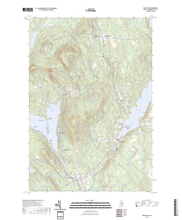
2024 Map of Hartland
USGS Topo · Published 2024About this map
Saint Albans and Hartland anchor this central Maine landscape where the Sebasticook River and Indian Stream converge. The topography is defined by prominent elevations such as Saint Albans Mtn and Mainstream Mtn, which overlook the expansive waters of Great Moose Lake and Indian Pond. These water bodies are punctuated by landmarks like Torry Island, Birch Island, and Packard Point, reflecting a geography tied to the river's path through Somerset County.
Find a feature on this map
107 named features on this map. Tap any name to fly to it.
Don’t see what you’re looking for? This feature index may not catch every label — zoom into the map to look around manually.
Map Details
Editions of this 2024 Hartland Map
This is the sole edition of this map. No revisions or reprints were ever made.
Other maps of this area

1913 · Skowhegan
USGS Topo · 1:62,500

1930 · Pittsfield
USGS Topo · 1:48,000

1932 · Pittsfield
USGS Topo · 1:62,500

1933 · Pittsfield
USGS Topo · 1:62,500

1933 · Guilford
USGS Topo · 1:62,500

1937 · Guilford
USGS Topo · 1:62,500

1948 · Bangor
USGS Topo · 1:250,000

1948 · Kingsbury
USGS Topo · 1:62,500

1950 · Kingsbury
USGS Topo · 1:62,500

1954 · Millinocket
USGS Topo · 1:250,000