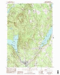
1982 Map of Hartland
USGS Topo · Published 1983About this map
The St Albans and Hartland townships center this Somerset County landscape, where the local economy and geography are defined by the convergence of the Sebasticook River and major water bodies. The village of Hartland is situated at the southern outlet of Great Moose Lake, while St Albans lies just west of Indian Pond. The map reveals a mix of agricultural land and wooded hills, notably St Albans Mtn and the series of peaks known as The Pinnacles. Local history is anchored by landmarks such as the Courser Memorial Sch and the Wing Cem. Smaller settlements like Todds Corner and Wildwood are connected by a network of rural roads and 4WD tracks, highlighting the area's transition into more remote timberlands and recreational sites like the Big Indian Camps.
Find a feature on this map
54 named features on this map. Tap any name to fly to it.
Don’t see what you’re looking for? This feature index may not catch every label — zoom into the map to look around manually.
Map Details
Editions of this 1982 Hartland Map
This is the sole edition of this map. No revisions or reprints were ever made.
Other maps of this area

1913 · Skowhegan
USGS Topo · 1:62,500

1930 · Pittsfield
USGS Topo · 1:48,000

1932 · Pittsfield
USGS Topo · 1:62,500

1933 · Pittsfield
USGS Topo · 1:62,500

1933 · Guilford
USGS Topo · 1:62,500

1937 · Guilford
USGS Topo · 1:62,500

1948 · Bangor
USGS Topo · 1:250,000

1948 · Kingsbury
USGS Topo · 1:62,500

1950 · Kingsbury
USGS Topo · 1:62,500

1954 · Millinocket
USGS Topo · 1:250,000