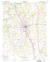
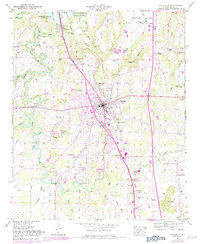
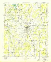
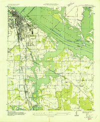
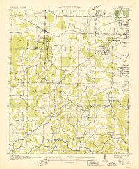
1949 Map of Hartselle
USGS Topo · Published 1970About this map
Hartselle serves as the focal point of this North Alabama survey, positioned along the vital Louisville and Nashville Railroad. The landscape is defined by the expansive backwaters of the Wheeler Reservoir and the Wheeler National Wildlife Refuge to the north, where Flint Creek winds through low-lying bottomlands. The presence of several rural landmarks, including the Salem Ch and Collins Sch, suggests a well-distributed agrarian community surrounding the town center. The mid-century revisions indicate post-war expansion with the addition of the Rountree Airfield and modern infrastructure like the sewage disposal bed and oxidation ponds. Transportation routes such as the Nashville and Decatur Line and local bridges like Barkley Bridge connect outlying settlements like Oak Ridge and Leesdale to the regional hub.
Find a feature on this map
58 named features on this map. Tap any name to fly to it.
Don’t see what you’re looking for? This feature index may not catch every label — zoom into the map to look around manually.
Map Details
Editions of this 1949 Hartselle Map
2 editions found
Other maps of this area

1888 · Cullman
USGS Topo · 1:125,000

1888 · Huntsville
USGS Topo · 1:125,000

1892 · Cullman
USGS Topo · 1:125,000

1892 · Huntsville
USGS Topo · 1:125,000
1927 · Falkville
USGS Topo · 1:24,000

1935 · Danville
USGS Topo · 1:48,000
1936 · Mc Kendry
USGS Topo · 1:24,000
1936 · Hartselle
USGS Topo · 1:24,000
1936 · Decatur
USGS Topo · 1:24,000
1936 · Trinity
USGS Topo · 1:24,000