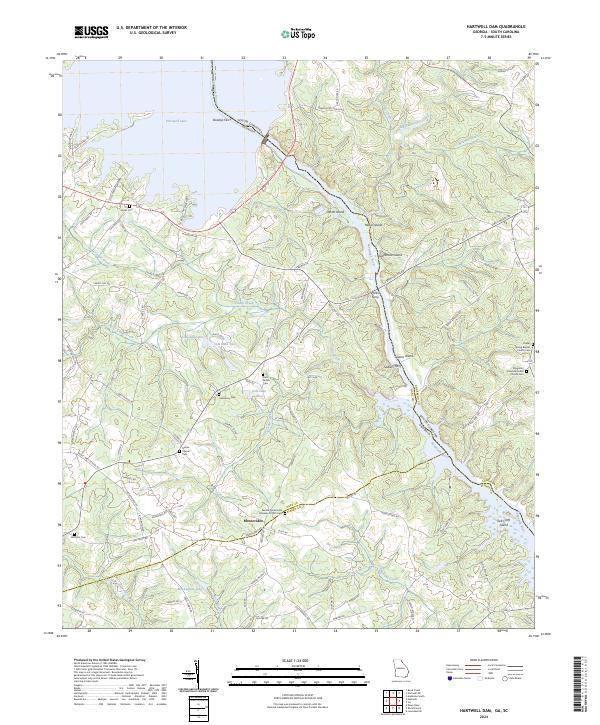
2024 Map of Hartwell Dam
USGS Topo · Published 2024About this map
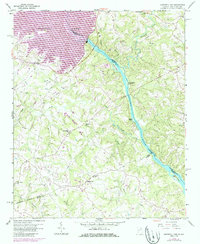
The Savannah River corridor and its surrounding uplands define this area along the Georgia and South Carolina border. The landscape is dominated by the sprawling southern reaches of Hartwell Lake, which has inundated the historical river valley and created numerous islands such as Derritt Island, Hewin Island, and Stephenson Island. The mapping highlights the transition from water to rural land, where the settlement of Montevideo serves as a local focal point near the Elbert County line.
Find a feature on this map
103 named features on this map. Tap any name to fly to it.
Don’t see what you’re looking for? This feature index may not catch every label — zoom into the map to look around manually.
Map Details
Editions of this 2024 Hartwell Dam Map
This is the sole edition of this map. No revisions or reprints were ever made.