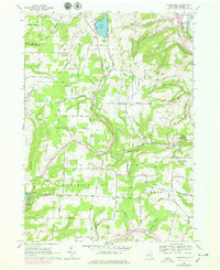
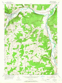
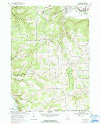
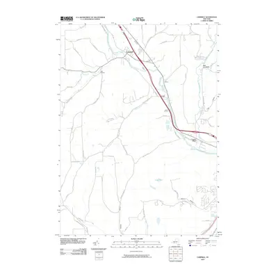
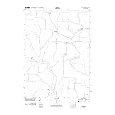
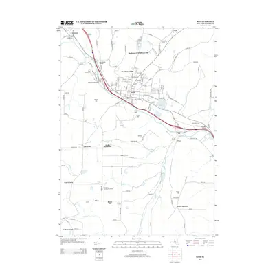
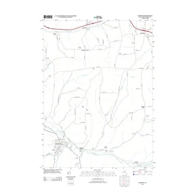
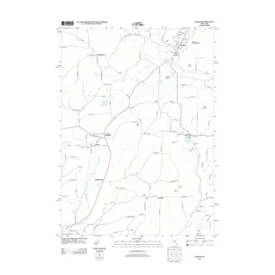
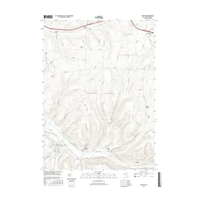
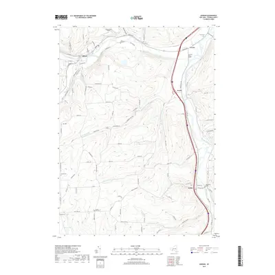
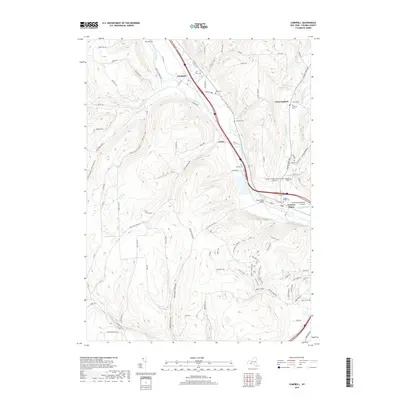
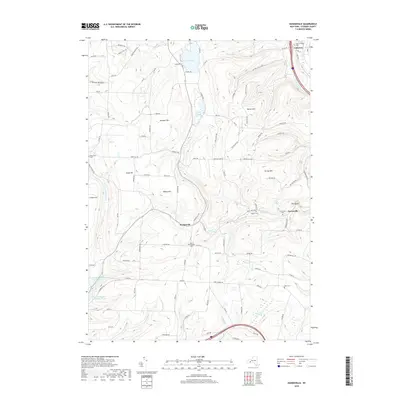
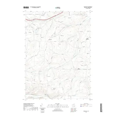
1978 Map of Haskinville
USGS Topo · Published 1978About this map
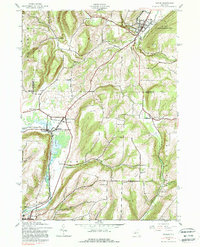
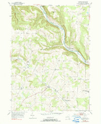
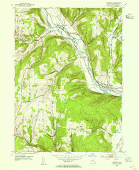
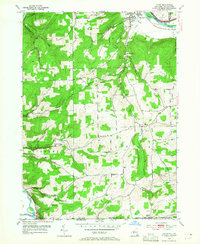
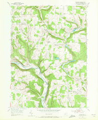
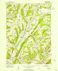
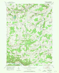
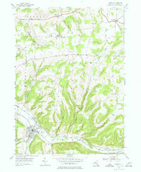
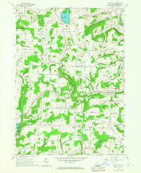
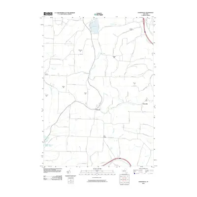
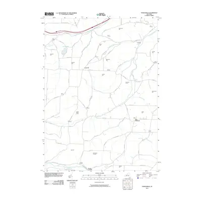
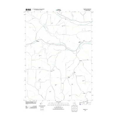
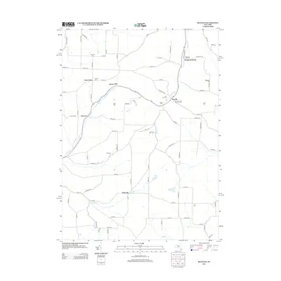
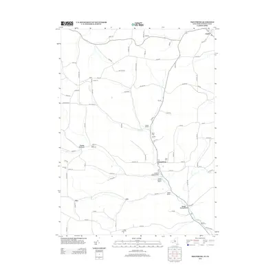
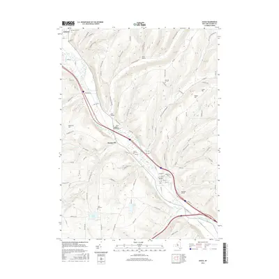
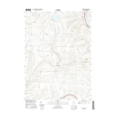
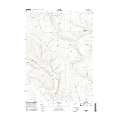
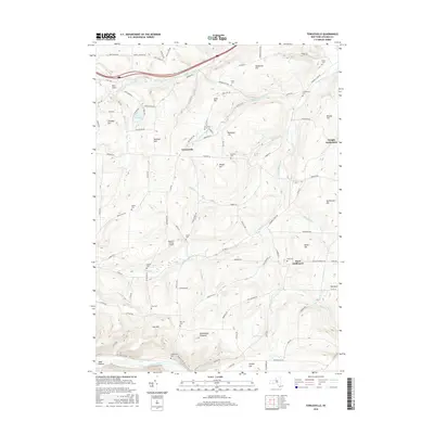
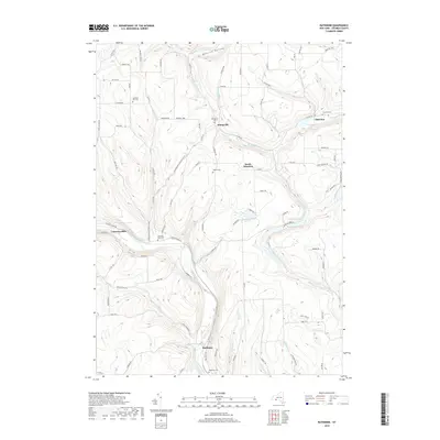
Loon Lake and the nearby Loon Lake Chapel anchor the northern landscape of this Steuben County region, where the terrain transitions from the high elevations of Bronson Hill and Potter Hill down toward the valley of the Cohocton River. The settlement pattern follows a network of rural routes, connecting small hubs like Keiffer Corners and the village of Haskinville, which features a Wesleyan Ch and a central cemetery. In the east, the Conrail line runs parallel to the river, serving the area near Greenville and the local Grange Hall. This map documents a period of land use defined by agriculture and water management, visible in the numerous Gravel Pits and the Hornell Res No 1 and Hornell Res No 2 reservoirs tucked into the southwestern hills. The inclusion of fine red dashed lines indicates field and fence lines, preserving the specific agricultural boundaries of the mid-1970s.
Find a feature on this map
101 named features on this map. Tap any name to fly to it.
Don’t see what you’re looking for? This feature index may not catch every label — zoom into the map to look around manually.
Map Details
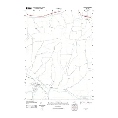
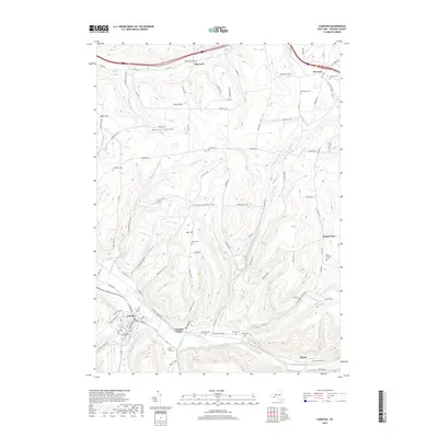
Editions of this 1978 Haskinville Map
This is the sole edition of this map. No revisions or reprints were ever made.
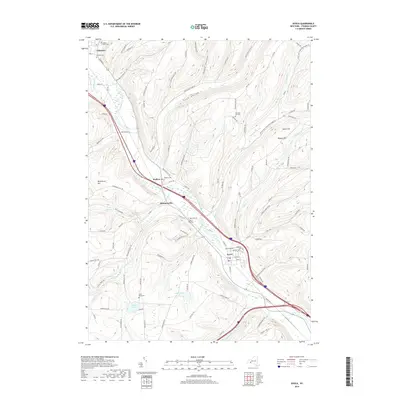
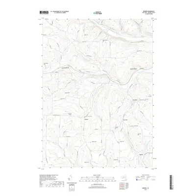
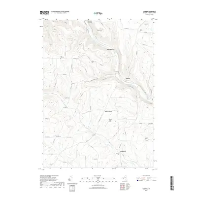
Historical Maps of Wayland Through Time
137 maps found
1910 Bath
Steuben County, NY
1926 Greenwood
Steuben County, NY
1926 Woodhull
Steuben County, NY
1942 Naples
Steuben County, NY
1942 Prattsburg
Steuben County, NY
1942 Pulteney
Steuben County, NY

1942 Wayland
Steuben County, NY
1943 Wayland
Steuben County, NY

1944 Woodhull
Steuben County, NY
1953 Addison
Steuben County, NY
1953 Avoca
Steuben County, NY
1953 Bath
Steuben County, NY
1953 Borden
Steuben County, NY
1953 Cameron
Steuben County, NY
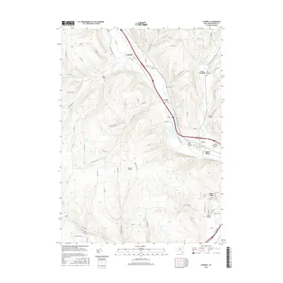
1953 Campbell
Steuben County, NY
1953 Caton
Steuben County, NY
1953 Rathbone
Steuben County, NY
1953 Rheims
Steuben County, NY
1953 Towlesville
Steuben County, NY
1953 Wayland
Steuben County, NY
1953 Woodhull
Steuben County, NY
1954 Canisteo
Steuben County, NY
1954 South Canisteo
Steuben County, NY
1954 Troupsburg
Steuben County, NY
1965 Greenwood
Steuben County, NY
1965 Haskinville
Steuben County, NY
1965 Rexville
Steuben County, NY
1969 Addison
Steuben County, NY
1969 Campbell
Steuben County, NY
1969 Caton
Steuben County, NY

1978 Greenwood
Steuben County, NY
1978 Haskinville
Steuben County, NY
2010 Avoca
Steuben County, NY
2010 Bath
Steuben County, NY
2010 Cameron
Steuben County, NY
2010 Campbell
Steuben County, NY
2010 Canisteo
Steuben County, NY
2010 Caton
Steuben County, NY
2010 Greenwood
Steuben County, NY
2010 Haskinville
Steuben County, NY
2010 Naples
Steuben County, NY
2010 Prattsburg
Steuben County, NY
2010 Pulteney
Steuben County, NY
2010 Rathbone
Steuben County, NY
2010 Rexville
Steuben County, NY
2010 Rheims
Steuben County, NY
2010 South Canisteo
Steuben County, NY
2010 Towlesville
Steuben County, NY
2010 Troupsburg
Steuben County, NY
2010 Wayland
Steuben County, NY
2012 Addison
Steuben County, NY
2012 Borden
Steuben County, NY
2012 Woodhull
Steuben County, NY
2013 Addison
Steuben County, NY
2013 Avoca
Steuben County, NY
2013 Bath
Steuben County, NY
2013 Borden
Steuben County, NY
2013 Cameron
Steuben County, NY
2013 Campbell
Steuben County, NY
2013 Canisteo
Steuben County, NY
2013 Caton
Steuben County, NY
2013 Greenwood
Steuben County, NY
2013 Haskinville
Steuben County, NY
2013 Naples
Steuben County, NY
2013 Prattsburg
Steuben County, NY
2013 Pulteney
Steuben County, NY
2013 Rathbone
Steuben County, NY
2013 Rexville
Steuben County, NY
2013 Rheims
Steuben County, NY
2013 South Canisteo
Steuben County, NY
2013 Towlesville
Steuben County, NY
2013 Troupsburg
Steuben County, NY
2013 Wayland
Steuben County, NY
2013 Woodhull
Steuben County, NY
2016 Addison
Steuben County, NY
2016 Avoca
Steuben County, NY
2016 Bath
Steuben County, NY
2016 Borden
Steuben County, NY
2016 Cameron
Steuben County, NY
2016 Campbell
Steuben County, NY
2016 Canisteo
Steuben County, NY
2016 Caton
Steuben County, NY
2016 Greenwood
Steuben County, NY
2016 Haskinville
Steuben County, NY
2016 Naples
Steuben County, NY
2016 Prattsburg
Steuben County, NY
2016 Pulteney
Steuben County, NY
2016 Rathbone
Steuben County, NY
2016 Rexville
Steuben County, NY
2016 Rheims
Steuben County, NY
2016 South Canisteo
Steuben County, NY
2016 Towlesville
Steuben County, NY
2016 Troupsburg
Steuben County, NY
2016 Wayland
Steuben County, NY
2016 Woodhull
Steuben County, NY
2019 Addison
Steuben County, NY
2019 Avoca
Steuben County, NY

2019 Bath
Steuben County, NY
2019 Borden
Steuben County, NY
2019 Cameron
Steuben County, NY
2019 Campbell
Steuben County, NY
2019 Canisteo
Steuben County, NY
2019 Caton
Steuben County, NY
2019 Greenwood
Steuben County, NY
2019 Haskinville
Steuben County, NY
2019 Naples
Steuben County, NY
2019 Prattsburg
Steuben County, NY
2019 Pulteney
Steuben County, NY
2019 Rathbone
Steuben County, NY
2019 Rexville
Steuben County, NY
2019 Rheims
Steuben County, NY
2019 South Canisteo
Steuben County, NY
2019 Towlesville
Steuben County, NY
2019 Troupsburg
Steuben County, NY
2019 Wayland
Steuben County, NY
2019 Woodhull
Steuben County, NY

2023 Addison
Steuben County, NY

2023 Avoca
Steuben County, NY

2023 Bath
Steuben County, NY

2023 Borden
Steuben County, NY

2023 Cameron
Steuben County, NY

2023 Campbell
Steuben County, NY

2023 Canisteo
Steuben County, NY

2023 Caton
Steuben County, NY

2023 Greenwood
Steuben County, NY

2023 Haskinville
Steuben County, NY

2023 Naples
Steuben County, NY

2023 Prattsburg
Steuben County, NY

2023 Pulteney
Steuben County, NY

2023 Rathbone
Steuben County, NY

2023 Rexville
Steuben County, NY

2023 Rheims
Steuben County, NY

2023 South Canisteo
Steuben County, NY

2023 Towlesville
Steuben County, NY

2023 Troupsburg
Steuben County, NY

2023 Wayland
Steuben County, NY

2023 Woodhull
Steuben County, NY