
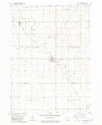
1980 Map of Havelock
USGS Topo · Published 1980About this map
The town of Havelock serves as a central hub in this agricultural landscape within Pocahontas County, Iowa. The town's grid is defined by its Park and a local Cemetery, marking the established community during the late 1970s. This region is a study in Iowa's engineered drainage and transport history, where natural waterways like Pilot Creek and the North Branch Lizard Creek are supplemented by man-made channels such as Ditch No 112 and Ditch No 169. The rail infrastructure is particularly prominent, showing the crossing of the Chicago and North Western and the Chicago Rock Island and Pacific railroads. These lines, alongside numerous Gravel Pits, highlight the industrial underpinnings of the rural economy, which is organized into the townships of Cummins, Powhatan, Roosevelt, Sherman, and Center.
Find a feature on this map
18 named features on this map. Tap any name to fly to it.
Don’t see what you’re looking for? This feature index may not catch every label — zoom into the map to look around manually.
Map Details
Editions of this 1980 Havelock Map
This is the sole edition of this map. No revisions or reprints were ever made.
Other maps of this area

1954 · Fort Dodge
USGS Topo · 1:250,000

1957 · Fort Dodge
USGS Topo · 1:250,000

1958 · Fort Dodge
USGS Topo · 1:250,000

1971 · Rush Lake East
USGS Topo · 1:24,000

1971 · Laurens
USGS Topo · 1:24,000

1979 · Pocahontas
USGS Topo · 1:24,000

1979 · Palmer
USGS Topo · 1:24,000

1979 · Fonda NE
USGS Topo · 1:24,000

1980 · Rolfe
USGS Topo · 1:24,000
1980 · Mallard
USGS Topo · 1:24,000