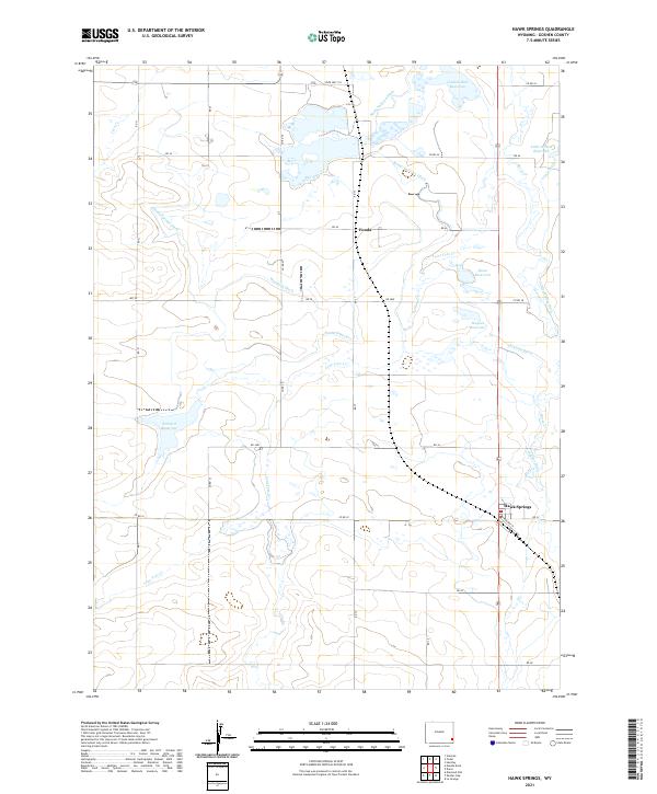
2021 Map of Hawk Springs
USGS Topo · Published 2021About this map
The irrigated plains of Goshen County define this agricultural landscape, where the settlement of Hawk Springs stands as a focal point for the region's ranching and farming operations. The map reveals a complex water management system essential for high-plains agriculture, including the substantial Goshen Hole Reservoir and Sinnard Reservoir. A network of man-made waterways like the Bump Sullivan Ditch, Woodard Ditch, and Hawk Springs Ditch weave through the landscape to support local fields, while natural drainages like Horse Cr and Lone Tree Cr provide the topography's skeletal structure. The small community of Fonda and the alignment of Railway St in Hawk Springs point to the historical transportation corridors that once moved livestock and produce across these Wyoming flats. For those tracing regional land use, the myriad of named reservoirs and ditches provides a clear record of how water was diverted to transform the dry prairie.
Find a feature on this map
43 named features on this map. Tap any name to fly to it.
Don’t see what you’re looking for? This feature index may not catch every label — zoom into the map to look around manually.
Map Details
Editions of this 2021 Hawk Springs Map
This is the sole edition of this map. No revisions or reprints were ever made.
Other maps of this area

1899 · Goshen Hole
USGS Topo · 1:125,000

1954 · Cheyenne
USGS Topo · 1:250,000

1958 · Cheyenne
USGS Topo · 1:250,000

1960 · Huntley
USGS Topo · 1:24,000

1960 · Veteran
USGS Topo · 1:24,000

1960 · Diamond Flat
USGS Topo · 1:24,000

1960 · Hawk Springs
USGS Topo · 1:24,000

1960 · Needle Rock
USGS Topo · 1:24,000

1960 · Kessler Gap
USGS Topo · 1:24,000

1960 · La Grange
USGS Topo · 1:24,000