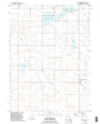
1990 Map of Hawk Springs
USGS Topo · Published 1995About this map
Goodland and Fonda appear as small rural nodes in this landscape defined by an intricate network of irrigation and water storage. Situated in Goshen County during the 1990s, the area's agricultural reliance on redirected water is evident in the dense system of channels such as the Hawk Springs Ditch, Sinnard Ditch, and Schwab Ditch. These man-made features weave between natural drainages like Corn Creek and Horse Creek, feeding numerous reservoirs used for both utility and conservation.
Find a feature on this map
25 named features on this map. Tap any name to fly to it.
Don’t see what you’re looking for? This feature index may not catch every label — zoom into the map to look around manually.
Map Details
Editions of this 1990 Hawk Springs Map
This is the sole edition of this map. No revisions or reprints were ever made.
Other maps of this area

1899 · Goshen Hole
USGS Topo · 1:125,000

1954 · Cheyenne
USGS Topo · 1:250,000

1958 · Cheyenne
USGS Topo · 1:250,000

1960 · Huntley
USGS Topo · 1:24,000

1960 · Veteran
USGS Topo · 1:24,000

1960 · Diamond Flat
USGS Topo · 1:24,000

1960 · Hawk Springs
USGS Topo · 1:24,000

1960 · Needle Rock
USGS Topo · 1:24,000

1960 · Kessler Gap
USGS Topo · 1:24,000

1960 · La Grange
USGS Topo · 1:24,000