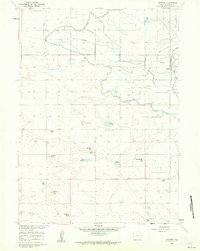
1960 Map of Veteran
USGS Topo · Published 1962About this map
The high plains of Goshen County are defined here by a sophisticated network of irrigation and water management, captured during the early 1960s. Central to the local economy is the Union Pacific railroad corridor, which serves the small settlement of Veteran. The landscape is a mix of ranching operations and hydraulic engineering, where the Fort Laramie Aqueduct and Fort Laramie Canal navigate the terrain to supply water to a series of man-made catchments like Eaton Reservoir and Yorges Reservoir.
Find a feature on this map
26 named features on this map. Tap any name to fly to it.
Don’t see what you’re looking for? This feature index may not catch every label — zoom into the map to look around manually.
Map Details
Editions of this 1960 Veteran Map
2 editions found
Other maps of this area

1896 · Patrick
USGS Topo · 1:125,000

1896 · Hartville
USGS Topo · 1:125,000

1899 · Goshen Hole
USGS Topo · 1:125,000

1901 · Hartville
USGS Topo · 1:125,000
1950 · Rockeagle
USGS Topo · 1:24,000

1954 · Torrington
USGS Topo · 1:250,000

1954 · Cheyenne
USGS Topo · 1:250,000

1958 · Cheyenne
USGS Topo · 1:250,000

1958 · Torrington
USGS Topo · 1:250,000
1960 · Habig Spring
USGS Topo · 1:24,000