
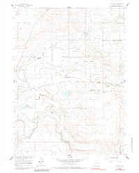
1960 Map of Huntley
USGS Topo · Published 1962About this map
Huntley and Holly anchor this agricultural landscape in Goshen County during the early 1960s, a period defined by the complex irrigation infrastructure of the Missouri River Basin project. The terrain is crisscrossed by an intricate network of engineered waterways, including the Fort Laramie Canal and the East Goshen Ditch. Notable technical landmarks like the Springer Aqueduct and the Pacific Union Siphon demonstrate the intensive water management required to support local farming near Horse Creek. Settlement patterns are sparse, marked by family-named features like J-Pen and local facilities such as Hillview Home, while several specialized drainage branches—like Katzer Drain and its various tributaries—carve through the township sections. This survey provides a precise view of the rural homesteads and hydraulic engineering that transformed this portion of the high plains into productive land.
Find a feature on this map
28 named features on this map. Tap any name to fly to it.
Don’t see what you’re looking for? This feature index may not catch every label — zoom into the map to look around manually.
Map Details
Editions of this 1960 Huntley Map
3 editions found
Other maps of this area

1896 · Patrick
USGS Topo · 1:125,000

1899 · Goshen Hole
USGS Topo · 1:125,000

1954 · Torrington
USGS Topo · 1:250,000

1954 · Cheyenne
USGS Topo · 1:250,000

1958 · Cheyenne
USGS Topo · 1:250,000

1958 · Torrington
USGS Topo · 1:250,000

1960 · Hawk Springs
USGS Topo · 1:24,000

1960 · Lyman
USGS Topo · 1:24,000
1960 · Duroc
USGS Topo · 1:24,000
1960 · Cottier
USGS Topo · 1:24,000