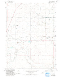
1960 Map of Huntley
USGS Topo · Published 1993About this map
Agricultural irrigation systems dominate this Goshen County landscape, where the Fort Laramie Canal and East Goshen Ditch supply a complex network of drains and laterals. Surveyed in the early 1960s, the map reveals a meticulously engineered environment designed to manage water in an arid region, evidenced by the Springer Main Aqueduct and the numerous branches of the Katzer Main Drain. Small settlements like Huntley and Holly serve as rural hubs, while the Hillview Home stands as a distinct local landmark.
Find a feature on this map
20 named features on this map. Tap any name to fly to it.
Don’t see what you’re looking for? This feature index may not catch every label — zoom into the map to look around manually.
Map Details
Editions of this 1960 Huntley Map
3 editions found
Other maps of this area

1896 · Patrick
USGS Topo · 1:125,000

1899 · Goshen Hole
USGS Topo · 1:125,000

1954 · Torrington
USGS Topo · 1:250,000

1954 · Cheyenne
USGS Topo · 1:250,000

1958 · Cheyenne
USGS Topo · 1:250,000

1958 · Torrington
USGS Topo · 1:250,000

1960 · Huntley
USGS Topo · 1:24,000

1960 · Hawk Springs
USGS Topo · 1:24,000

1960 · Lyman
USGS Topo · 1:24,000
1960 · Duroc
USGS Topo · 1:24,000