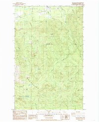
1985 Map of Haystack Mtn
USGS Topo · Published 1985About this map
Skagit Valley landforms dominate the northern portion of this 1980s landscape, where the Day Creek settlement sits at the base of the high timberlands. The terrain transitions rapidly from the valley floor into the steep elevations of the Cultus Mountains, a region marked by extensive extractive activity. Resource extraction is evident through numerous quarries and a Gravel Pit scattered among the peaks of Haystack Mtn and Talc Mountain.
Find a feature on this map
28 named features on this map. Tap any name to fly to it.
Don’t see what you’re looking for? This feature index may not catch every label — zoom into the map to look around manually.
Map Details
Editions of this 1985 Haystack Mtn Map
This is the sole edition of this map. No revisions or reprints were ever made.
Other maps of this area

1899 · Stillaguamish
USGS Topo · 1:125,000

1901 · Stilaguamish
USGS Topo · 1:125,000

1909 · Mt Baker
USGS Topo · 1:192,000

1911 · Mount Vernon
USGS Topo · 1:125,000

1915 · Mt. Baker
USGS Topo · 1:250,000

1921 · Wickersham
USGS Topo · 1:62,500

1944 · Clear Lake
USGS Topo · 1:62,500

1951 · Wickersham
USGS Topo · 1:62,500

1952 · Hamilton
USGS Topo · 1:62,500

1955 · Concrete
USGS Topo · 1:250,000