2024 Map of Helen
USGS Topo · Published 2024About this map
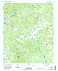
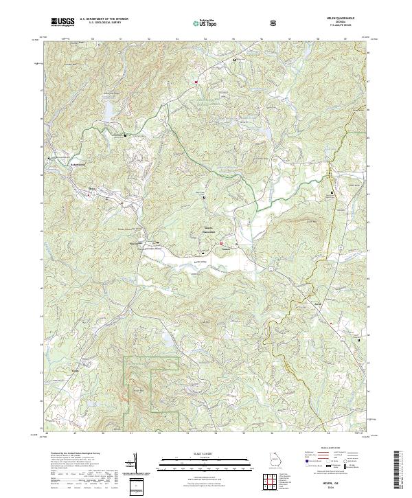
Nacoochee Indian Mound serves as a prominent historical anchor in the Sautee-Nacoochee Valley, where the Chattahoochee River begins its long journey southward. This alpine-inspired region of Northeast Georgia is characterized by its deep valleys and significant peaks, including Yonah Mtn and Pink Mtn. The map reveals a high concentration of cemeteries and local houses of worship, such as Union Baptist Church Cem and Chattahoochee Methodist Church, which speak to the area's long-established family lineages. Transportation routes like Edelweiss Strasse and Brucken Strasse in Helen reflect the unique Bavarian-themed development of the town, while the Chattahoochee National Forest boundary protects the surrounding highlands. The landscape is further defined by several controlled water bodies, including Unicoi Lake and the various reservoirs of the Sautee Cr Watershed Number 12 Lake.
Find a feature on this map
191 named features on this map. Tap any name to fly to it.
Don’t see what you’re looking for? This feature index may not catch every label — zoom into the map to look around manually.
Map Details
Editions of this 2024 Helen Map
This is the sole edition of this map. No revisions or reprints were ever made.