2023 Map of Helper
USGS Topo · Published 2023About this map
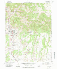
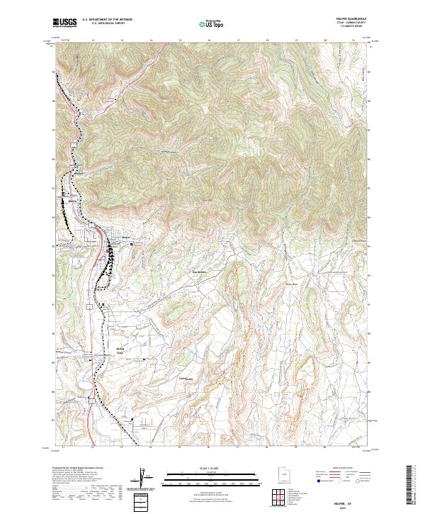
The industrial corridor of the Price River dominates this modern Utah landscape, where the town of Helper remains the central hub for local rail and mining history. The steep terrain of the Book Cliffs and canyons like Hardscrabble Canyon hem in the settlements of Kenilworth and Spring Glen, creating a distinct linear development pattern along the valley floor. Evidence of the region’s coal mining heritage is visible in the network of legacy infrastructure, such as the Old RR Grade and Kenilworth RR Grade that once climbed these heights.
Find a feature on this map
60 named features on this map. Tap any name to fly to it.
Don’t see what you’re looking for? This feature index may not catch every label — zoom into the map to look around manually.
Map Details
Editions of this 2023 Helper Map
This is the sole edition of this map. No revisions or reprints were ever made.