2021 Map of Hemingford
USGS Topo · Published 2021About this map
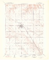
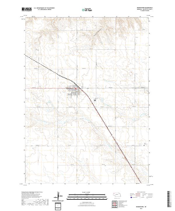
Hemingford sits as the central hub of this agricultural landscape in Box Butte County, Nebraska, organized around a tight grid of streets such as Niobrara Ave and Box Butte Ave. The surrounding High Plains terrain is etched by the intricate drainage systems of N Br Box Butte Cr, S Br Box Butte Cr, and Hemingford Cr, which flow through the sectioned farmland. The map reveals the critical role of water management in this semi-arid region, evidenced by the Fisher Reservoir west of the village. For local historians and genealogists, the map provides precise locations for the Hemingford Cem and the more remote Saint Johns Cem to the southeast. The survey also captures the rugged topography of the South Branch Sand Canyon carving through the northern townships, contrasting with the rectilinear precision of county roads like Dodge Rd and Gage Rd.
Find a feature on this map
40 named features on this map. Tap any name to fly to it.
Don’t see what you’re looking for? This feature index may not catch every label — zoom into the map to look around manually.
Map Details
Editions of this 2021 Hemingford Map
This is the sole edition of this map. No revisions or reprints were ever made.
Historical Maps of Box Butte County Through Time
3 maps found