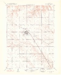
1948 Map of Hemingford
USGS Topo · Published 1948About this map
Hemingford serves as the focal point of this High Plains landscape, situated at the intersection of a grid-iron street plan and the Chicago Burlington and Quincy railroad. The village's infrastructure in the late 1940s is clearly defined, featuring a Landing Field to the northwest and a Sewage Disposal plant to the southeast. Outside the village core, the rural sections of Box Butte County are organized around essential local institutions, including Sch No 49, Sch No 81, and Sch No 125, which provided localized education for ranching families.
Find a feature on this map
16 named features on this map. Tap any name to fly to it.
Don’t see what you’re looking for? This feature index may not catch every label — zoom into the map to look around manually.
Map Details
Editions of this 1948 Hemingford Map
2 editions found
Other maps of this area

1946 · Nonpareil
USGS Topo · 1:24,000

1946 · Box Butte Reservoir West
USGS Topo · 1:24,000

1947 · Box Butte NW
USGS Topo · 1:24,000

1948 · Box Butte Reservoir West
USGS Topo · 1:24,000

1948 · Hemingford
USGS Topo · 1:24,000

1948 · Berea Creek West
USGS Topo · 1:24,000

1948 · Hemingford 4 NE
USGS Topo · 1:24,000

1948 · Hemingford 4 NW
USGS Topo · 1:24,000

1948 · Nonpareil
USGS Topo · 1:24,000

1948 · Box Butte Reservoir East
USGS Topo · 1:24,000