
1948 Map of Hemingford 4 NW
USGS Topo · Published 1948About this map
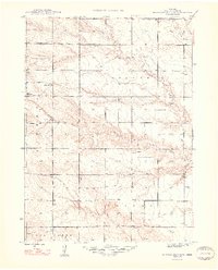
Nonpareil Creek and Snake Creek drain this section of the High Plains, where a sparse network of country schoolhouses once served the rural families of Wright and neighboring townships. Mapped in 1946 for the Bureau of Reclamation, the landscape is defined by its agricultural utility, evidenced by the numerous windmills dotting the drainages. The terrain breaks at Point of Rocks, a prominent escarpment that disrupts the flat plateau. Five distinct rural schools, including School No 51 and School No 19, provide specific coordinates for family researchers and genealogists tracing early twentieth-century homesteading patterns in this remote portion of Box Butte County.
Find a feature on this map
12 named features on this map. Tap any name to fly to it.
Don’t see what you’re looking for? This feature index may not catch every label — zoom into the map to look around manually.
Map Details
Editions of this 1948 Hemingford 4 NW Map
3 editions found
Other maps of this area

1946 · Nonpareil
USGS Topo · 1:24,000

1948 · Hemingford
USGS Topo · 1:24,000

1948 · Hemingford 4 SW
USGS Topo · 1:24,000

1948 · Hemingford 4 SE
USGS Topo · 1:24,000

1948 · Hemingford 4 NE
USGS Topo · 1:24,000

1948 · Nonpareil
USGS Topo · 1:24,000

1951 · Marsland
USGS Topo · 1:62,500

1951 · Kilpatrick Lake
USGS Topo · 1:62,500

1955 · Alliance
USGS Topo · 1:250,000

1957 · Alliance
USGS Topo · 1:250,000