1948 Map of Hemingford 4 SE
USGS Topo · Published 1948About this map
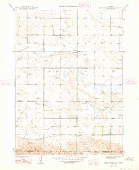
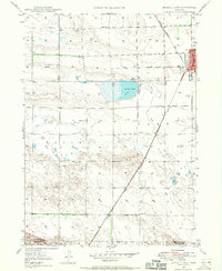
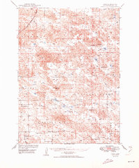
Snake Creek meanders through this High Plains landscape, which was mapped shortly after World War II for the Bureau of Reclamation. The map reveals a sparsely settled rural area where the economy was driven by ranching and agriculture, as evidenced by the high density of Windmills dotting the terrain to tap into vital groundwater. Cultural landmarks are localized at key sections, including the Hagaman Cem and rural education centers such as School No 9 and School No 16. The northern portion of the quadrangle is marked by the distinct topographic rise of Point Rocks, providing a rare elevation change in the otherwise rolling landscape. The southern edge of the survey identifies the political boundary shared by Box Butte and Morrill counties, crossing through the townships of Wright and Bonner.
Find a feature on this map
9 named features on this map. Tap any name to fly to it.
Don’t see what you’re looking for? This feature index may not catch every label — zoom into the map to look around manually.
Map Details
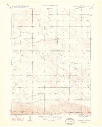
Editions of this 1948 Hemingford 4 SE Map
3 editions found

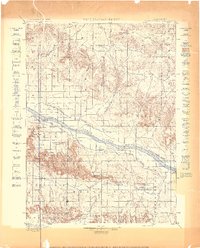
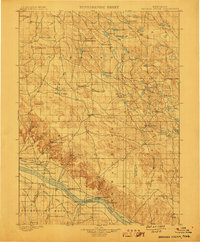
Other maps of this area

1896 · Browns Creek
USGS Topo · 1:125,000
1898 · Camp Clarke
USGS Topo · 1:125,000
1899 · Browns Creek
USGS Topo · 1:125,000
1947 · Bronco Lake
USGS Topo · 1:24,000
1948 · Hemingford 4 SW
USGS Topo · 1:24,000

1948 · Berea Creek West
USGS Topo · 1:24,000
1948 · Hemingford 4 NE
USGS Topo · 1:24,000
1948 · Hemingford 4 NW
USGS Topo · 1:24,000
1949 · Lynn
USGS Topo · 1:62,500

1949 · Bronco Lake
USGS Topo · 1:24,000